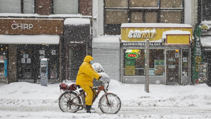
The nor'easter that paralyzed New York and blanketed the East and Midwest with heavy snow will edge its way along the coast as a blast of Arctic air sweeps behind it, sending temperatures tumbling across the central U.S.
New York's Central Park received 19.3 inches (49 centimeters) since Sunday, which makes the storm the city's ninth heaviest since 1869, said Rob Carolan, owner of Hometown Forecast Services Inc. The bulk of the snow fell Monday, setting a record for the date, according to the National Weather Service.
"The setup was perfect for the tri-state area to get buried," said Carolan, who provides forecasts for Bloomberg Radio. "The radar looked like a fire hose coming off the Atlantic."
The storm closed covid vaccination sites across the region and tied up road and rail traffic, with trains and subways being suspended in New York on Monday. While school buildings were closed, many students were still required to log on for remote learning.
Gov. Andrew Cuomo, D, declared a state of emergency in 44 counties, and New York Mayor Bill de Blasio, D, enacted a travel ban in the city. More than 3,100 flights in the U.S. have been canceled since Sunday, according to Flight Aware, an airline tracking service.
There will be some light snowfall Tuesday, "but it will be more of a digging out and cleaning up," Cuomo said on 1010 WINS radio.
With the worst of the storm over in the Mid-Atlantic, Metro North trains resumed regular service, while the Long Island Rail Road is operating on a weekend schedule. Amtrak is operating on a modified schedule. New York schools are still closed through Tuesday, with students learning from home. New York subways began operating above ground at 5 a.m.
New York has ordered all vaccine sites to honor appointments. "It will be honored, and that is a state order," Cuomo said Tuesday.
The storm will linger off the East Coast with snow showers continuing across large cities along the Interstate 95 corridor, but the heaviest amounts will fall in interior New York and New England, said Lara Pagano, a meteorologist with the U.S. Weather Prediction Center. The highest total from the storm so far was Nazareth, Penn., about 80 miles (129 kilometers) west of New York, which received 31 inches.
Along the Massachusetts coast, Boston's Logan International Airport got 1.2 inches, while suburbs just to the north and west got between 17 to 20 inches, Carolan said.
As the snow heads off to Canada, frigid, Arctic air is set to rip into the Great Plains and Midwest, sending temperatures 10 to 20 degrees Fahrenheit (6 to 11 Celsius), or more, below normal later this week, Pagano said. Lows will reach 3 degrees Fahrenheit in Milwaukee Friday and 6 in Chicago. Minneapolis will be minus 2.By early next week, some of that cold will arrive in the East, she said.
Throughout the season, winter has been relatively mild across the U.S. with few major snowstorms and above-normal temperatures. Meteorologists have been predicting a blast of cold after a sudden stratospheric warming event occurred over the Arctic earlier this year, which usually precedes a breakdown of the polar vortex and allows frigid air to spill southward into Asia, Europe and North America.
The cold could mean temperatures dropping 5 to 8 degrees below normal across the eastern half of the U.S. from Feb. 7 to 16, according to Matt Rogers, president of the Commodity Weather Group LLC. That will drive up energy demand, and possibly shore up natural gas prices. "A significant pattern change favoring a two-week period of very cold air appears," said Jim Rouiller, lead meteorologist with the Energy Weather Group. "The full wrath of winter arrives in the East in a week."
But the cold will likely prove short-lived, with temperatures becoming milder again in March, he added.

