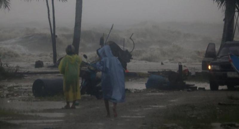
Pabuk thrashes into the south

Tropical storm weakens after making landfall, but risk remains high of flash floods and landslides

Multiple reports indicate that Koh Samui, Koh Tao, Koh Pha-ngan and the eastern coast of Nakhon Si Thammarat are imperilled by waves at least three metres high and strong winds. Mountainous inland areas of Nakhon Si Thammarat, Surat Thani, Phang Nga, Trang and Krabi are at risk of flash floods and landslides.
The Meteorological Department announced that the storm made landfall in Nakhon Si Thammarat’s Pak Phanang district at 4pm Friday, carrying winds at speeds of up to 75 kilometres per hour.
Though the storm is expected to lose strength as it crosses the South bound for the Andaman Sea, the department believes it will remain powerful, heading northwest towards Surat Thani at 18kph.

It issued a warning of heavy downpours and strong winds on Saturday for Phetchaburi, Prachuap Khiri Khan, Chumphon, Surat Thani, Nakhon Si Thammarat, Phatthalung, Ranong, Phang Nga, Phuket, Krabi, Trang and Satun.
Thon Thamrongnawasawat of Kasetsart University’s Faculty of Fisheries said that, even though the Gulf would calm once Pabuk moved on, strong winds and high waves would continue to batter the eastern coasts of Koh Samui, Koh Tao and Koh Pha-ngan in Surat Thani and the coast of Nakhon Si Thammarat.
Anond Snidvongs, director of Geo Informatics and Space Technology Development Agency, said it detected six-metre-high waves off the eastern coast of Koh Samui. Judging by the direction of the wind, he said, the waves would be carried to the shores of Nakhon Si Thammarat and Surat Thani.

The Meteorological Department also advised all ships to remain anchored until at least Sunday. Coastal residents have been told to be wary of surges as strong winds whip up waves five metres high in the Gulf and three metres in the Andaman.
Thon cautioned residents living inland that the storm was expected to linger until Saturday morning at least and bring enormous amounts of rain to Surat Thani, Nakhon Si Thammarat, Phang Nga, Phuket, Krabi and Trang, intensifying the risk of flash floods and landslides.
“Torrential rain is expected to flood low-lying areas in those provinces for quite a long time because drainage will be slowed by high tides,” he said.
Phuwieng Prakhammintara, director-general of the Meteorological Department, said the storm had slowed to just 13kph after hitting a maximum speed of 65kph.
“Due to its slow movement, rain will continue over large parts of the South, so people should be aware of forest runoffs and flash floods, especially tonight [Friday],” he said.
The Royal Irrigation Department said 1,031 areas across the South were at the risk of flash floods and landslides.

Since Pabuk is expected to move over the Andaman on Saturday, Thon predicts rough conditions, but he said the waves would not be as high as they were in the Gulf during the storm.
Nevertheless, he advised fishermen and tourists to avoid going out to sea because it was still too dangerous.
The Hydro and Agro Informatics Institute said Nakhon Si Thammarat’s Lan Saka district had already witnessed 220 millimetres of rain as of Friday evening. Many areas in the South were expected to get more than 300mm of rain overnight.
Pabuk’s impact on Thursday and Friday was severe along the eastern coasts of Nakhon Si Thammarat and Songkhla. Nakhon Si Thammarat’s Phak Phanang district was the worst hit on Friday. It was pounded by gales of up to 120kph and intensive flooding. Coastal areas of the district were crushed under high waves, shutting down traffic and damaging buildings along the shore.
Pattani on the southern border suffered less than expected, though there was at least one casualty after a fishing vessel sank in rough seas.
