
RID issues seven-province warning over Chao Phraya Dam water release
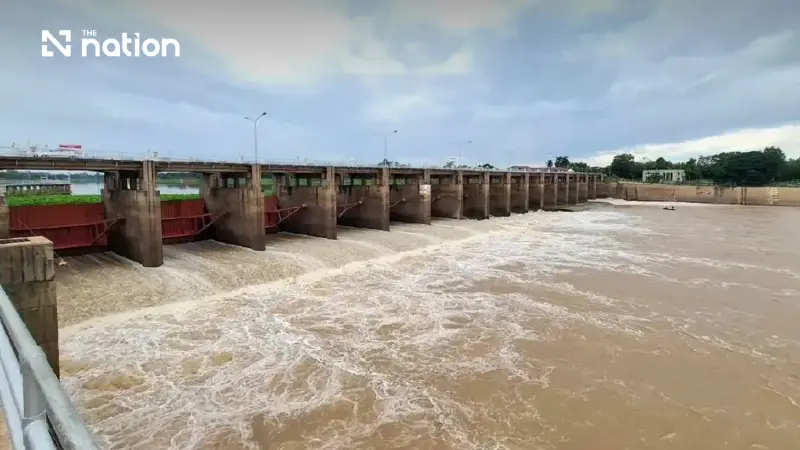


The Royal Irrigation Department expects flow through the dam to rise to 500–700 cubic metres per second, lifting downstream levels by 1–1.5 metres.
- The Royal Irrigation Department (RID) has warned seven provinces in the Chao Phraya River Basin about an increased water release from the Chao Phraya Dam, prompted by higher runoff from the north.
- The dam's discharge is forecast to increase to 500–700 cubic metres per second, which is expected to raise downstream water levels by 1–1.5 metres.
- The seven provinces put on alert are Uthai Thani, Chai Nat, Sing Buri, Ang Thong, Suphan Buri, Phra Nakhon Si Ayutthaya, and Lop Buri.
The Royal Irrigation Department (RID) has warned seven provinces in the Chao Phraya River Basin to prepare as higher flows from the North gradually reach the Chao Phraya Dam.
It expects discharge from the dam to rise to 500–700 cubic metres per second, lifting downstream water levels by 1–1.5 metres, and said it was making every effort to minimise the impact on the public.
Witthaya Kaewmee, director-general of the RID, said the department was closely monitoring water conditions and water management throughout the Chao Phraya River Basin.

Runoff from the upper basin had begun flowing gradually into the area above the Chao Phraya Dam, with volumes expected to continue rising.
Station C.2 in Mueang Nakhon Sawan district, Nakhon Sawan province, recorded a flow of about 936 cubic metres per second at 6am on Monday (August 24, 2026).
This lifted the water level upstream of the Chao Phraya Dam to +15.94 metres above mean sea level, while discharge downstream of the dam remained controlled at 450 cubic metres per second.
The RID will manage the water by maintaining the level upstream of the Chao Phraya Dam within an appropriate range in line with upstream flow conditions, enabling the dam to accommodate incoming water and minimise downstream impacts.
It will also channel water into irrigation systems on both the eastern and western sides, and has emphasised that irrigation projects in the area must monitor water volumes closely.
Flow through the Chao Phraya Dam is forecast to increase to about 500–700 cubic metres per second.
This would raise downstream water levels by about 1–1.5 metres from their current level, from Sapphaya district in Chai Nat province to Ban Krathum and Hua Wiang subdistricts in Sena district and Tha Din Daeng subdistrict in Phak Hai district, Phra Nakhon Si Ayutthaya province.
The water would remain below bank level.
“I have instructed Regional Irrigation Office 12 and the relevant agencies to remain vigilant and monitor water conditions closely, and to ensure that machinery, equipment and personnel are ready to respond to high-flow conditions and assist people promptly,” Witthaya said.

The RID issued its seventh water-situation warning for the Chao Phraya River Basin, dated Monday, and sent it to the governors of seven provinces in the basin: Uthai Thani, Chai Nat, Sing Buri, Ang Thong, Suphan Buri, Phra Nakhon Si Ayutthaya and Lop Buri.
The warning was also sent to relevant agencies, which were told to step up public communications and alert people living along both banks of the Chao Phraya River to remain vigilant and closely follow official updates.
The RID stressed that it would make every effort to manage the water, with the impact on the public as its foremost consideration.
The RID’s warning and preparations will help people in at-risk riverside areas across the seven Central Region provinces respond promptly to rising water levels.
Balanced water management will help ease hardship and effectively reduce losses caused by high-water conditions.

