
Thailand develops multi-hazard tools to anticipate climate risks
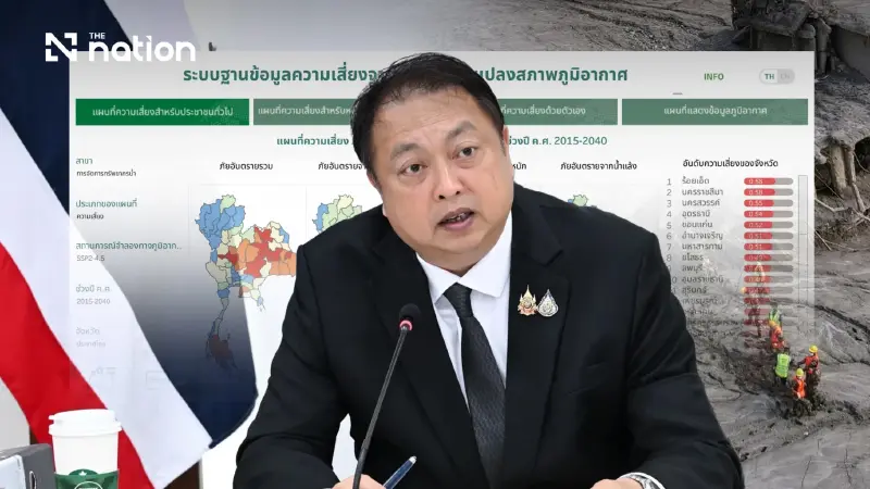


Thailand is developing a three-to-six-month Multi-Hazard Index and long-term Climate Risk Map to help agencies prepare for overlapping threats.
- Thailand is developing two new tools to shift from reactive disaster response to proactive preparation for climate change risks.
- A short-term 'Multi-Hazard Index' will forecast which areas are likely to face single or multiple hazards like floods, droughts, and landslides over the next three to six months.
- A long-term 'Climate Risk Map' will show risks such as sea-level rise and temperature changes up to the year 2100 to support long-range planning.
- The data from both tools will be published through the Climate Change Information Centre to help agencies and the public prepare and minimize losses.
Suchart Chomklin, Minister of Natural Resources and Environment, said the glacier-collapse disaster on the Tibet–Nepal border on Wednesday (August 26, 2026), which left many people dead or missing, showed that climate change is making disasters more severe and their patterns more complex.
Hazards may not occur in isolation; several may unfold in succession or occur simultaneously, causing widespread damage.
“Although Thailand does not face the same glacier-related risk as Tibet and Nepal, the country is experiencing the effects of climate change in many forms, including floods, droughts, windstorms, landslides and mudslides, as well as extreme heat. It is therefore vital that we know in advance which areas are at risk and what hazards may occur, so that agencies and the public can prepare before an event and minimise losses as far as possible,” Suchart said.
Suchart said the government prioritised climate change preparedness and had therefore instructed the Department of Climate Change and Environment to accelerate the development of climate-risk data.
This would allow agencies to use the information to plan preventive and adaptation measures suited to each area.
To date, the department has developed long-term climate projections extending to 2100, covering key variables such as rainfall, temperature and humidity.
Eleven agencies have already used the information to analyse and assess risks in line with their respective responsibilities.
For fiscal 2027, Suchart said he had instructed the department to accelerate the development of a ‘Multi-Hazard Index’, a tool designed to help ‘look ahead’ and identify which areas are likely to face which hazards over the next three to six months.
These include heavy rain, flooding, drought, landslides and extreme heat.
The index will also assess which areas may face several hazards during the same period.
Dr Phirun Saiyasitpanich, director-general of the Department of Climate Change and Environment, said the Multi-Hazard Index would be developed at a spatial resolution of 5 × 5 kilometres to provide a clearer picture of risk.
It would combine information on several climate-related hazards, including heavy rain, flooding, drought, landslides and extreme heat.
“The key point is that we will not only examine which hazards an area may face, but also whether several hazards could occur together or in succession, and which areas should be monitored particularly closely over the next three to six months, so the relevant agencies can prepare personnel and equipment and plan assistance for the public in advance,” Phirun said.
Suchart added that, beyond preparedness over the next three to six months, he had also instructed the department to develop a ‘Climate Risk Map’.
This would show the degree of climate risk in different areas, particularly at subdistrict level, covering four key risks: landslides, sea-level rise, long-term increases in average temperature and changes in rainfall.
The map will be displayed using GIS and cover both a scenario based on current greenhouse gas emissions and a high-emissions scenario. Risks will be presented across two time horizons.
The first runs from the present to 2050 and can support local planning, such as urban planning, infrastructure development and provincial response plans.
The second covers the period after 2050 and up to 2100, showing long-term risk trends such as sea-level rise.
“We must shift from waiting for disasters to occur and only then responding, to understanding the risks and preparing as much as possible before they occur. The two tools are therefore important and complementary: the Multi-Hazard Index will help us identify risks over the next three to six months, while the Climate Risk Map will help us plan for the long term,” Suchart said.
Once both tools have been completed, the Department of Climate Change and Environment will publish the data through the Climate Change Information Centre (CCIC), enabling central agencies, local agencies and other relevant bodies to use it to plan disaster-prevention and adaptation measures suited to the risks in each area.
“The central aim is to put data and technology to practical use for the public, enabling Thailand to identify risks in advance, prepare more quickly and minimise losses to life, property, the economy and society, while building the country’s resilience so it can live sustainably with climate change,” Suchart said.
