
Mobile data centre to fight floods
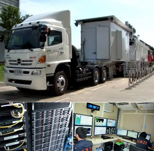


Science minister unveils Bt90 million facility, which aims to give fast assessments
ASIA’S FIRST MOBILE data centre – which aims to monitor and promptly address flood problems, notably emergencies – was unveiled yesterday.
“In the past, when a flood hit, power was shut down and there was no other connection of mobile devices, so the measurement of floods was delayed for the authorities’ assessment,” Science and Technology Minister Pichet Durongkaveroj said.
That will no longer be an issue, as the Mobile Data Centre would help the Thai government make decisions on tackling floods faster, he told the press during at the launch of the centre yesterday and a demonstration at the Thailand Science Park in Pathum Thani province.
The Bt90-million centre, equipped with a 30TB super-computer, serves as a concise and mobile database of water and weather information.
It has the capacity to respond to a flood even when communication systems are down.
The centre would help related agencies to prepare contingency plans, flood disaster assessment and recovery planning.
Pichet explained that the centre would assess information in the available water database first, then conduct a “field” assessment in the affected area. Next it would report back to state agencies, including the provincial governor up to the prime minister, for further decisions, he said.
The centre uses satellite information systems for an operation, so it could make conclusions about a flood situation within just a few hours, he said.
Has own power generators
The data centre is the size of three containers and has its own electricity generators, which could keep the unit up and running for eight hours, Pichet said.
“Because we have energy storage by ourselves, we have no concern about a particular event such as a blackout occurring, ” he said.
The centre could move around at 60kmh and wade through 80cm-deep floodwater. It also was equipped with a mobile mapping system (MMS) to measure road height and water barriers, a four-wheel-drive truck and a GPS-equipped patrol boat to accurately measure water levels, as well as a unmanned aerial vehicle to capture still and motion images from 200 metres above ground.
The Mobile Data Centre was developed by Hydro and Agro Informatics Institute.
It uses water information that is obtained via collaboration with over 30 state agencies. It is part of the water management plan to cope with Thai floods in the short- and long-term.
