
Heavy rain to hit Thailand Sept 23–27, Bangkok downpours and 2–3m upper Gulf waves
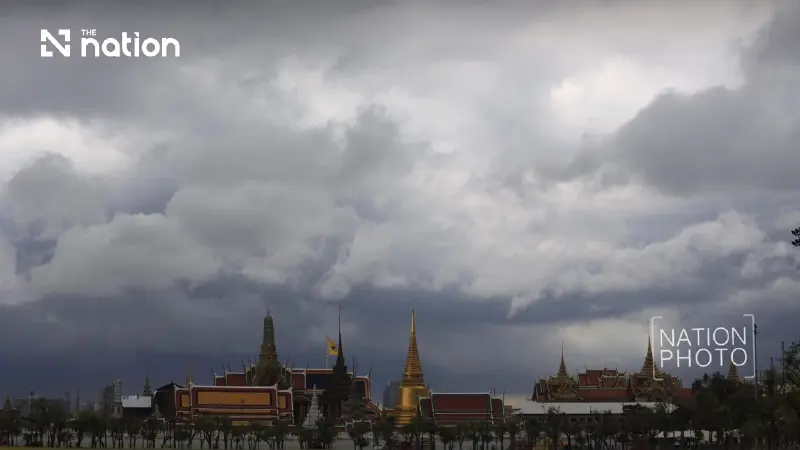


Bangkok faces very heavy rain on September 24–27, while small boats in Thailand’s upper Gulf are advised to stay ashore from September 23–27
- Thailand's meteorological department has forecast a spell of heavy to very heavy rain across the country from September 23-27, bringing significant risks of flash floods and forest run-off.
- Waves in the upper Gulf of Thailand are expected to reach 2–3 meters during this period, and could exceed 3 meters in thunderstorms, prompting a warning for small boats to stay ashore.
- The severe weather is attributed to a strong low-pressure system moving over Thailand, combined with a strengthening southwest monsoon over the Andaman Sea and the Gulf.
- Key areas affected by the heavy rain include the lower North, lower Northeast, Central region, East, and upper South, with Bangkok also expecting very heavy downpours from September 24-27.
The Thai Meteorological Department (TMD) has warned of a fresh spell of heavy to very heavy rain across parts of Thailand from September 23–27, 2026, bringing flash-flood risks and waves of 2–3 metres in the upper Gulf of Thailand.
The TMD’s September 21–27 weather outlook identifies the lower North, lower Northeast, Central region, East and upper South as the main areas facing widespread heavy rain, with very heavy downpours in some places. Accumulated rainfall could trigger flash floods and forest run-off, particularly on foothill slopes near waterways and in low-lying areas. A strong low-pressure system near the central Vietnamese coast is expected to move over Thailand along the monsoon trough across the upper part of the country. The south-west monsoon over the Andaman Sea, southern Thailand and the Gulf will also strengthen.
For September 22, the TMD outlook forecasts isolated heavy rain in the North, lower Northeast, Central region, including Bangkok and surrounding provinces, East and the South’s east coast.
The TMD attributes the September 22 conditions to a weakening high-pressure system, or cool air mass, from China over the upper North and upper Northeast. A monsoon trough remains across the lower Central region, upper South and East, extending towards a strong low-pressure system over the central South China Sea, while a moderate south-west monsoon covers the upper Andaman Sea and upper Thailand.
Regional forecasts show heavier rain later in the week
The TMD’s September 21–27 regional outlook forecasts very heavy rain in parts of the lower North on September 25–26 and in Bangkok and surrounding provinces on September 24–27. The regional forecasts are:
North: Thunderstorms are forecast across 60–70% of the region throughout September 21–27, with isolated heavy rain and very heavy downpours in parts of the lower North on September 25–26. Easterly winds will reach 10–20km/h, with minimum temperatures of 22–27°C and maximum temperatures of 29–36°C.
Northeast: Thunderstorms will cover 60–70% of the region on September 21–22, with isolated heavy rain in the lower part, before expanding to 70–80% on September 23–27, when isolated heavy to very heavy rain is forecast. Easterly winds will reach 10–20km/h, with minimum temperatures of 23–26°C and maximum temperatures of 28–35°C.
Central region: Thunderstorms will cover 60–70% of the region on September 21–23, with isolated heavy rain, increasing to 70–80% on September 24–27, with isolated heavy to very heavy downpours. Variable winds will reach 10–20km/h, with minimum temperatures of 22–27°C and maximum temperatures of 30–35°C.
East: Thunderstorms are forecast across 60–70% of the region on September 21–22, with isolated heavy rain, expanding to 70–80% on September 23–27, when isolated heavy to very heavy rain is expected. Minimum temperatures will range from 23–26°C and maximum temperatures from 29–34°C; the changing winds and sea conditions are detailed below.
South, east coast: Thunderstorms will cover 40–60% of the area on September 21–23, with isolated heavy rain, rising to 60–70% on September 24–27, with isolated heavy to very heavy downpours. Minimum temperatures will be 22–27°C and maximum temperatures 29–35°C.
South, west coast: Thunderstorms will cover 40–60% of the area on September 21–23, with isolated heavy rain, increasing to 60–70% on September 24–27, with isolated heavy to very heavy rain. Minimum temperatures will range from 23–26°C and maximum temperatures from 29–34°C.
Bangkok and surrounding provinces: Thunderstorms are forecast across 70–80% of the area throughout September 21–27, with isolated heavy rain and very heavy downpours in some places on September 24–27. Variable winds will reach 10–20km/h, with minimum temperatures of 24–27°C and maximum temperatures of 31–35°C.

Upper Gulf waves could exceed 3 metres in thunderstorms
The TMD forecasts waves of 2–3 metres in the upper Gulf on September 23–27, rising above 3 metres in thunderstorms, and advises small boats in that area to remain ashore. Mariners throughout the Andaman Sea and Gulf should proceed cautiously and avoid thunderstorms throughout the forecast period.
For September 22, the TMD outlook puts waves in the upper Andaman Sea and upper Gulf at 1–2 metres, exceeding 2 metres in thunderstorms. From September 23–27, waves in the upper Andaman Sea and lower Gulf are expected to reach about 2 metres and exceed that height in thunderstorms.
The TMD’s detailed coastal forecast is:
- Eastern coast, September 21–22: Variable winds of 15–35km/h and waves of 1–2 metres, exceeding 2 metres in thunderstorms.
- Eastern coast, September 23–27: Variable winds strengthen to 20–40km/h, with waves of 2–3 metres and more than 3 metres in thunderstorms.
- Southern Gulf coast, September 21–22: Waves of about 1 metre, rising to 1–2 metres offshore and exceeding 2 metres in thunderstorms.
- Surat Thani northwards, September 23–27: South-westerly winds of 20–40km/h, with waves of 2–3 metres and more than 3 metres in thunderstorms.
- Nakhon Si Thammarat southwards, September 23–27: South-westerly winds of 20–35km/h, with waves of about 2 metres and more than 2 metres in thunderstorms.
- Phuket northwards, September 21–22: South-westerly winds of 15–35km/h, with waves of 1–2 metres and more than 2 metres in thunderstorms.
- Krabi southwards, September 21–22: South-westerly winds of 15–30km/h, with waves of about 1 metre and about 2 metres in thunderstorms.
- Phuket northwards, September 23–27: South-westerly winds of 20–35km/h, with waves of about 2 metres and more than 2 metres in thunderstorms.
- Krabi southwards, September 23–27: South-westerly winds of 15–35km/h, with waves of 1–2 metres and more than 2 metres in thunderstorms.
Flood and landslide watch covers September 22–26
The Office of the National Water Resources (ONWR) has identified areas requiring monitoring for waterlogging, flash floods, forest run-off and mudslides during September 22–26, according to Thansettakij’s report on the assessment.
ONWR’s assessment draws on rainfall forecasts from the TMD and the Hydro-Informatics Institute (Public Organization), together with forecasts of flash-flood and landslide risks in upstream areas from the Department of Water Resources and Department of Mineral Resources. ONWR also identifies the approaching low-pressure system and strengthening south-west monsoon as the drivers of increased rainfall.
The September 22–26 flood and landslide watch lists the following locations, with districts shown in brackets:
North: Mae Hong Son (Sop Moei, Mae Sariang and Khun Yuam); Tak (Umphang, Tha Song Yang, Mae Ramat and Mae Sot); Phitsanulok (Noen Maprang, Chat Trakan and Wang Thong); and Uthai Thani (Lan Sak and Ban Rai).
Northeast: Si Sa Ket (Phu Sing).
Central region: Lopburi (Mueang Lopburi and Nong Muang); Saraburi (Nong Khae and Phra Phutthabat); Pathum Thani (Mueang Pathum Thani); Nonthaburi (Mueang Nonthaburi and Pak Kret); Bangkok; and Samut Prakan (Bang Bo).
West: Kanchanaburi (Sangkhla Buri, Si Sawat, Phanom Thuan and Thong Pha Phum); and Ratchaburi (Chom Bueng and Suan Phueng).
East: Nakhon Nayok (Pak Phli and Mueang Nakhon Nayok); Prachin Buri (Mueang Prachin Buri, Si Maha Phot and Prachantakham); Sa Kaeo (Aranyaprathet, Watthana Nakhon and Khao Chakan); Chonburi (Mueang Chonburi, Bo Thong, Si Racha and Ban Bueng); Chanthaburi (Makham, Kaeng Hang Maeo, Pong Nam Ron, Khlung and Khao Khitchakut); and Trat (Mueang Trat and Bo Rai).
South: Ranong (Kapoe); Songkhla (Hat Yai, Khlong Hoi Khong and Sadao); and Narathiwat (Ra-ngae, Sukhirin and Su-ngai Kolok).
ONWR’s September 22–26 assessment also calls for monitoring of sudden rises, overflowing riverbanks and flooding in low-lying areas along the following main waterways and their tributaries:
- Mae Hong Son: Moei and Yuam rivers, and the Mae Sariang waterway.
- Phitsanulok: Wang Thong River.
- Ratchaburi: Phachi River.
- Nakhon Nayok: Nakhon Nayok River.
- Prachin Buri: Prachin Buri River.
- Sa Kaeo: Phra Sathueng and Phra Prong canals.
- Chanthaburi: Chanthaburi River.
- Ranong: Kapoe Canal.
- Narathiwat: Sai Buri and Kolok rivers.
Chao Phraya Dam flows could raise downstream levels by 0.75–1.25 metres
ONWR forecasts that run-off from the upper Chao Phraya basin will pass through Chao Phraya Dam at about 1,500 cubic metres per second, potentially raising downstream water levels by approximately 0.75–1.25 metres above the levels recorded when the assessment was made.
ONWR identifies low-lying land outside flood embankments as particularly exposed to the projected rise. The Nation has also reported on Bangkok’s warning over rising Chao Phraya water levels.
The downstream locations listed in ONWR’s warning are:
- Chai Nat: Sapphaya district.
- Sing Buri: In Buri district.
- Ang Thong: Mueang Ang Thong and Wiset Chai Chan districts.
- Phra Nakhon Si Ayutthaya: Sena, Phak Hai, Bang Ban, Phra Nakhon Si Ayutthaya, Bang Pa-in and Bang Sai districts.
- Pathum Thani: Mueang Pathum Thani and Sam Khok districts.
