
TMD warns two Thai provinces of very heavy rain on Sept 14
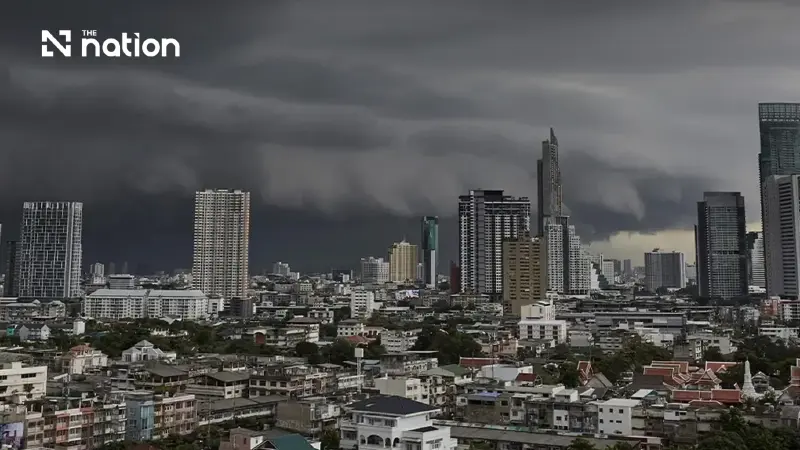


Ubon Ratchathani and Trat risk very heavy rain on September 14–15, with thunderstorms across 60% of Bangkok and nearby provinces
- The Thai Meteorological Department forecasts isolated very heavy rain in Ubon Ratchathani and Trat during September 14–15, 2026.
- The department expects thunderstorms across 70% of the Northeast, Central region and each southern coastal forecast area.
- Bangkok and surrounding provinces are forecast to have thunderstorms across 60% of the area.
- The department advises mariners in the Andaman Sea and Gulf of Thailand to avoid thunderstorms.
The Thai Meteorological Department (TMD) has forecast isolated very heavy rain in two provinces, Ubon Ratchathani and Trat, for Monday (September 14, 2026), with heavy rain elsewhere in Thailand bringing risks of flash floods, forest run-off and mudslides.
The TMD’s 24-hour forecast runs from 6am on September 14 to 6am on September 15, 2026, Thailand time (UTC+7).
TMD warns of flash floods and mudslides
The TMD warned that heavy and accumulated rainfall could cause flash floods, forest run-off and mudslides, particularly on foothill slopes near waterways and in low-lying areas.
People in affected areas should avoid routes repeatedly hit by flooding, the TMD advised, particularly through low-lying locations where water can accumulate over a short period.
The TMD attributed the unsettled weather to a monsoon trough extending across the upper South, the East and the lower Northeast towards a strong low-pressure area over central Vietnam.
A moderate south-westerly monsoon also continues to cover the lower Andaman Sea, the lower South and the lower Gulf of Thailand, according to the TMD.
TMD forecasts thunderstorms across 60–70% of each region
The TMD forecasts thunderstorms across 60–70% of each forecast area during the period ending at 6am on September 15. The percentages describe thunderstorm coverage, with heavy rain expected in parts of the specified provinces.
North: Thunderstorms across 60% of the region, with isolated heavy rain in Tak, Kamphaeng Phet, Phitsanulok, Phichit and Phetchabun. Lows of 21–27°C and highs of 32–37°C, with north-easterly winds at 10–20 km/h.
Northeast: Thunderstorms across 70% of the region, with isolated heavy rain in Bueng Kan, Udon Thani, Sakon Nakhon, Nakhon Phanom, Chaiyaphum, Khon Kaen, Kalasin, Mukdahan, Maha Sarakham, Yasothon, Amnat Charoen and Si Sa Ket. Ubon Ratchathani faces isolated very heavy rain. Lows of 22–25°C and highs of 26–32°C, with variable winds at 10–25 km/h.
Central region: Thunderstorms across 70% of the region, with isolated heavy rain in Nakhon Sawan, Uthai Thani, Lop Buri, Saraburi, Phra Nakhon Si Ayutthaya, Suphan Buri, Kanchanaburi and Ratchaburi. Lows of 23–25°C and highs of 31–35°C, with easterly winds at 10–20 km/h.
East: Thunderstorms across 60% of the region, with isolated heavy rain in Nakhon Nayok, Chon Buri, Rayong and Chanthaburi. Trat faces isolated very heavy rain. Lows of 23–25°C and highs of 30–35°C, with variable winds at 15–35 km/h.
South, east coast: Thunderstorms across 70% of the area, with isolated heavy rain in Phetchaburi, Prachuap Khiri Khan, Chumphon, Surat Thani, Pattani, Yala and Narathiwat. Lows of 22–25°C and highs of 32–36°C. Winds are variable at 15–35 km/h from Surat Thani northwards, and south-westerly at 15–35 km/h from Nakhon Si Thammarat southwards.
South, west coast: Thunderstorms across 70% of the area, with isolated heavy rain in Ranong and Phang Nga. Lows of 23–25°C and highs of 31–34°C. Winds are variable at 20–35 km/h from Phuket northwards, and south-westerly at 15–35 km/h from Krabi southwards.
Bangkok and surrounding provinces: Thunderstorms across 60% of the area, with lows of 24–26°C and highs of 32–34°C. Easterly winds at 10–20 km/h.
Andaman Sea and Gulf waves may exceed two metres in storms
The TMD expects waves above two metres in thunderstorms in the Andaman Sea and Gulf of Thailand, with moderate winds and waves more generally. Mariners in both areas should navigate cautiously and avoid thunderstorms.
Along the eastern seaboard, waves are forecast at 1–2 metres, rising above two metres in thunderstorms.
Along the South’s east coast, waves are forecast at about one metre, increasing to 1–2 metres offshore and exceeding two metres in thunderstorms.
In the upper Andaman Sea, from Phuket northwards, waves are forecast at about two metres and above two metres in thunderstorms. From Krabi southwards, waves are expected at 1–2 metres, rising above two metres in thunderstorms.
