
Prachin Buri floods cover over 500,000 rai in Oct 2 image
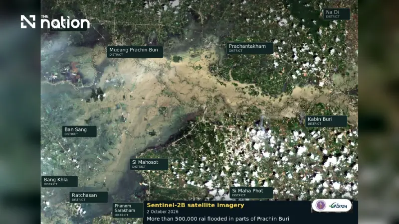


Sentinel-2B imagery shows widespread flooding in Prachin Buri, with data shared to help agencies plan relief, manage affected areas and aid recovery.
- A Sentinel-2B satellite image from October 2 revealed that floods have inundated more than 500,000 rai in Prachin Buri.
- Thailand's space agency, GISTDA, attributed the water's murky brown color to soil sediment and mud from upstream agricultural areas.
- The satellite data is being shared with relevant agencies to assist in planning relief, management, and recovery efforts.
Thailand’s Geo-Informatics and Space Technology Development Agency (GISTDA), a public organisation, has released Sentinel-2B imagery captured on October 2, 2026, showing floodwater covering more than 500,000 rai across several districts of Prachin Buri.
GISTDA explains sediment and current patterns
GISTDA attributed the murky brown appearance of the floodwater to soil sediment, mud and topsoil carried downstream from agricultural land upstream.
GISTDA also said bands of different shades indicated variations in the strength of the current, with lighter tones signifying faster-flowing water. The explanation accompanied the agency’s account of the satellite imagery.

Satellite data shared for relief and recovery
GISTDA has passed the information to relevant agencies to help plan assistance, manage affected areas and support recovery once the flooding subsides.
