
Bangkok sends cell broadcast as canal levels reach critical stage



Bangkok residents have been warned of rising canal levels and flooding, with people in low-lying and canal-side areas urged to move belongings to higher ground and check routes before travelling.
The Department of Disaster Prevention and Mitigation (DDPM) sent a Cell Broadcast alert to mobile phones across Bangkok at 9.22am on Saturday (September 26), warning that canal water levels had reached critical levels and were continuing to rise.
The alert advised residents living along canals and in low-lying areas to move belongings to higher ground, secure valuables in safe places and prepare for further increases in water levels.
People were also urged to avoid travelling through flooded areas and to check road conditions before setting out.
Anyone requiring assistance was advised to contact their local district office so officials could coordinate support.
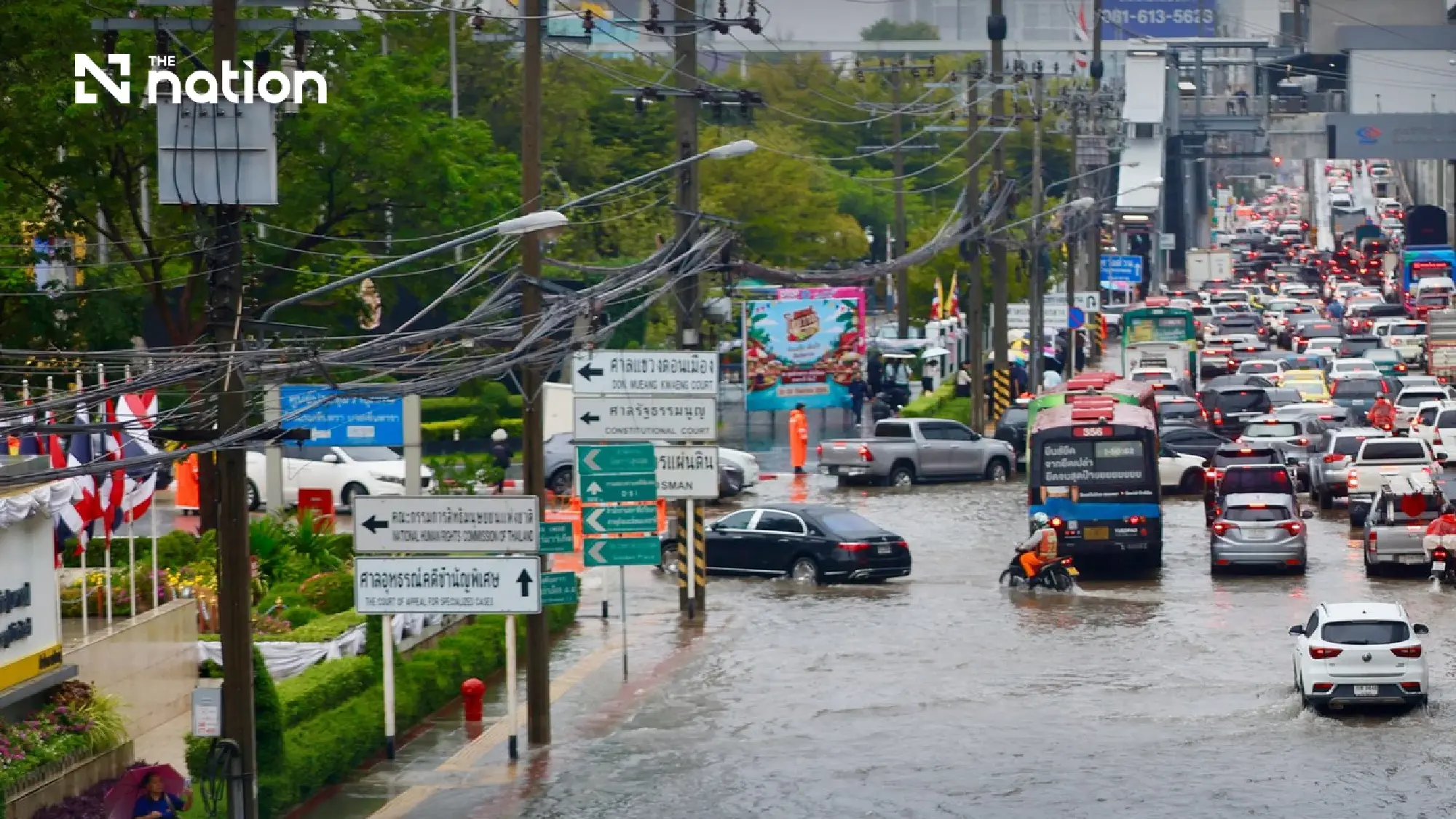
The warning came as persistent heavy rain caused flooding and waterlogging in several parts of Bangkok, with authorities continuing to closely monitor rainfall and water levels.

Bangkok launches real-time travel warning system
Following overnight downpours that left several parts of the capital flooded on Saturday morning, the Bangkok Metropolitan Administration (BMA) made available a real-time travel monitoring and warning system to help motorists assess conditions before travelling at https://claude.ai/artifact/N6umcENfSgoY6GMkhVKwZs
According to the information provided, 21 major routes were classified as red, indicating severe flooding, critical conditions and heavy traffic congestion.
The red-alert routes are:
- Suwinthawong Road: Min Buri to Wat Saen Suk, Min Buri district
- Lat Krabang Road: Suvarnabhumi Airport frontage to Lat Krabang, Lat Krabang district
- Vibhavadi Rangsit Road: Chatuchak-Lak Si-Don Mueang
- Phahonyothin Road: Lat Phrao intersection-Kasetsart University-Bang Bua-Lak Si-Saphan Mai
- Din Daeng Road: Din Daeng intersection to Asok-Din Daeng intersection
- Ratchadaphisek Road: Rama IX-Huai Khwang-Lat Phrao intersection-Ratchayothin
- Phatthanakan Road: Entire route in Suan Luang district
- Chaeng Watthana Road: Lak Si to Chaeng Watthana Expressway
- Lat Phrao Road: Ratchada-Lat Phrao intersection-Wang Thonglang-Bang Kapi, including Lat Phrao sois 101-130
- Srinakarin Road: Bang Kapi-Hua Mak-Phatthanakan-On Nut-Seacon-Bang Na
- On Nut Road, or Sukhumvit 77: On Nut 17-Srinakarin intersection-Prawet
- Ramkhamhaeng Road: Ramkhamhaeng University-Bang Kapi-Saphan Sung
- Ngam Wong Wan Road: The Mall Ngamwongwan to Kasetsart intersection
- New Phetchaburi Road: Makkasan-Asok-Thong Lo-Ekkamai
- Asok-Din Daeng Road: Din Daeng to Phetchaburi
- Pradit Manutham Road: Along the Ram Inthra expressway
- Sukhumvit Road: Bang Na-Udom Suk
- Rama IX Road: Rama IX intersection-Central Rama 9-RCA
- Sihaburanukit Road: Min Buri Market to Min Buri intersection
- Inner Phahonyothin Road: Saphan Khwai-Ari
- Ram Inthra Road: Bang Khen Monument-Ram Inthra Km 4-Ram Inthra expressway night market

Five more routes placed on orange alert
Another five routes were classified as orange, indicating moderate flooding and slow-moving traffic requiring close monitoring.
They are:
- Kamphaeng Phet 2 Road: Bang Sue-Chatuchak Market
- Rajavithi Road: Victory Monument-Dusit
- Si Ayutthaya Road: Phaya Thai-Dusit
- Bang Na-Trat Road: Beneath the Burapha Withi Expressway around Si Iam intersection
- Rama II Road: A short section around Lotus’s Rama II in Bang Khun Thian district
Under the BMA warning system, red means severe flooding and routes should be avoided immediately, orange indicates moderate flooding with slow traffic, while green means normal travel conditions with no reported waterlogging.
