
Upper Thailand under widespread rain warning from monsoon trough
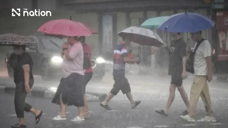


Heavy to very heavy rain is forecast from Sunday to Wednesday, with flood risks on land and waves exceeding three metres during thunderstorms in the upper Andaman Sea.
- A heavy to very heavy rain warning is in effect for upper Thailand from August 30 to September 2 due to a monsoon trough.
- The most affected areas include the North, Northeast, Central, and East regions, with a risk of flash floods and run-off.
- The weather is caused by a monsoon trough shifting south and a strong south-west monsoon over the Andaman Sea and Gulf of Thailand.
- Mariners are also warned of strong winds and high waves of 2-3 meters, with small boats in the upper Andaman Sea advised to stay ashore.
The Thai Meteorological Department (TMD) has issued a warning of heavy to very heavy rain across upper Thailand from August 30 to September 2.
Rainfall is forecast to increase across Thailand during the period, with heavy to very heavy falls in some areas, particularly in the western parts of the North and Central regions, the upper and eastern parts of the Northeast, and the East.
The monsoon trough is expected to shift southwards across the North and upper Northeast towards an active low-pressure cell over the coast of upper Vietnam and the Gulf of Tonkin.
A relatively strong south-west monsoon will also prevail over the Andaman Sea, Thailand and the Gulf of Thailand.

People in the affected areas are advised to remain alert to hazards from heavy to very heavy rain and accumulated rainfall, which may cause flash floods and rapid run-off, particularly on foothill slopes near waterways and in low-lying areas.
They should avoid routes prone to recurrent flooding, especially low-lying stretches where temporary flooding may occur.
Wind and wave conditions in the upper Andaman Sea will be relatively strong, with waves of 2–3 metres and more than 3 metres during thunderstorms.
Waves in the lower Andaman Sea and upper Gulf of Thailand will be about 2 metres, rising above 2 metres during thunderstorms.
Mariners in the Andaman Sea and Gulf of Thailand should proceed with caution and avoid areas of thunderstorms.
Small boats in the upper Andaman Sea should remain ashore throughout the period.

North
- Thunderstorms are forecast across 70% of the region, with heavy rain in parts of Mae Hong Son, Chiang Mai, Lamphun, Lampang, Phrae, Uttaradit, Phitsanulok, Phichit and Phetchabun.
- Very heavy rain is expected in parts of Chiang Rai, Phayao, Nan and Tak.
- Minimum temperatures: 23–27°C.
- Maximum temperatures: 30–34°C.
- South-westerly winds: 10–20 km/h.
Northeast
- Thunderstorms are forecast across 70% of the region, with heavy rain in parts of Nong Khai, Udon Thani, Kalasin, Mukdahan, Maha Sarakham, Roi Et, Yasothon, Amnat Charoen and Ubon Ratchathani.
- Very heavy rain is expected in parts of Bueng Kan, Sakon Nakhon and Nakhon Phanom.
- Minimum temperatures: 23–25°C.
- Maximum temperatures: 30–35°C.
- South-westerly winds: 10–25 km/h.
Central region
- Thunderstorms are forecast across 60% of the region, with heavy rain in parts of Kanchanaburi, Ratchaburi, Lop Buri and Saraburi.
- Minimum temperatures: 23–26°C.
- Maximum temperatures: 34–36°C.
- South-westerly winds: 10–25 km/h.
East
- Thunderstorms are forecast across 70% of the region, with heavy rain in parts of Nakhon Nayok, Prachin Buri, Sa Kaeo and Rayong.
- Very heavy rain is expected in parts of Chanthaburi and Trat.
- Minimum temperatures: 23–26°C.
- Maximum temperatures: 27–34°C.
- South-westerly winds: 20–35 km/h.
- Waves will be about 2 metres, rising above 2 metres during thunderstorms.
South (east coast)
- Thunderstorms are forecast across 40% of the region, with heavy rain in parts of Phetchaburi, Prachuap Khiri Khan and Surat Thani.
- Minimum temperatures: 23–27°C.
- Maximum temperatures: 32–37°C.
- From Surat Thani northwards, south-westerly winds will reach 20–35 km/h. Waves will be 1–2 metres, about 2 metres offshore and more than 2 metres during thunderstorms.
- From Nakhon Si Thammarat southwards, south-westerly winds will reach 15–35 km/h. Waves will be about 1 metre, rising to 1–2 metres offshore and more than 2 metres during thunderstorms.
South (west coast)
- Thunderstorms are forecast across 40% of the region, with heavy rain in parts of Ranong, Phang Nga and Krabi.
- Minimum temperatures: 23–27°C.
- Maximum temperatures: 28–34°C.
- From Phuket northwards, south-westerly winds will reach 20–40 km/h. Waves will be 2–3 metres and more than 3 metres during thunderstorms.
- From Krabi southwards, south-westerly winds will reach 20–35 km/h. Waves will be about 2 metres and more than 2 metres during thunderstorms.
Bangkok and surrounding areas
- Thunderstorms are forecast across 60% of the area, with heavy rain in some places.
- Minimum temperatures: 25–26°C.
- Maximum temperatures: 33–35°C.
- South-westerly winds: 10–25 km/h.
