
Storm Saudel linked to heavy rainfall and flood risks in upper Thailand
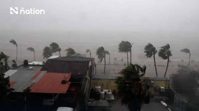


Heavy to very heavy rain is forecast through Wednesday (September 2, 2026), while four Mekong provinces monitor rising levels and overflow risks until Sunday (September 6, 2026).
- Tropical Storm Saudel is contributing to a monsoon trough that is causing heavy to very heavy rainfall across upper Thailand, particularly in the North and Northeast regions.
- The Thai Meteorological Department has warned residents in affected areas of potential flash floods and rapid run-off due to the intense and accumulated rainfall.
- Four provinces along the Mekong River—Nong Khai, Bueng Kan, Nakhon Phanom, and Mukdahan—have been specifically alerted to monitor rising water levels, with forecasts predicting the river may overflow its banks.
- While the storm is influencing Thailand's weather, it is not expected to make landfall in the country and is forecast to move towards Taiwan.
The Thai Meteorological Department (TMD) issued a weather advisory on September 1, warning of heavy to very heavy rain in upper Thailand through September 2.
The provinces at risk during the two days are as follows:
Areas at risk on September 1
Very heavy rain
- Northeast: Ubon Ratchathani.
Heavy rain
- North: Mae Hong Son, Chiang Mai, Chiang Rai, Lampang, Nan, Uttaradit, Tak, Phitsanulok, Phichit and Phetchabun.
- Northeast: Loei, Nong Khai, Bueng Kan, Sakon Nakhon, Nakhon Phanom, Chaiyaphum, Mukdahan, Yasothon, Amnat Charoen, Nakhon Ratchasima, Buri Ram, Surin and Si Sa Ket.
- Central: Lop Buri, Saraburi and Kanchanaburi.
- East: Nakhon Nayok, Prachin Buri, Sa Kaeo, Chanthaburi and Trat.
Areas at risk on September 2
Very heavy rain
- Northeast: Amnat Charoen and Ubon Ratchathani.
Heavy rain
- North: Mae Hong Son, Chiang Mai, Chiang Rai, Lampang, Phayao, Nan, Phrae, Tak, Uttaradit and Phitsanulok.
- Northeast: Loei, Bueng Kan, Udon Thani, Sakon Nakhon, Nakhon Phanom, Kalasin, Mukdahan, Roi Et, Yasothon, Surin and Si Sa Ket.
- East: Nakhon Nayok, Prachin Buri, Chanthaburi and Trat.
- South: Ranong and Phang Nga.
Parts of Thailand are expected to receive heavy to very heavy rain, particularly the North and the eastern part of the Northeast.
A monsoon trough lies across the North and upper Northeast before extending into Tropical Storm Saudel over the upper South China Sea, while a rather strong southwest monsoon prevails over the Andaman Sea, Thailand and the Gulf of Thailand.
TMD urged people in the affected areas to beware of heavy to very heavy rain and accumulated rainfall, which may cause flash floods and rapid run-off, particularly on foothill slopes near waterways and in low-lying areas.
Travellers should avoid routes with recurrent flooding, especially low-lying locations that may experience short-term inundation.
Winds and waves over the upper Andaman Sea will be rather strong, with waves 2–3 metres high and more than 3 metres in thundershowers.
The upper Gulf of Thailand will have waves about 2 metres high and more than 2 metres in thundershowers.
Mariners in the Andaman Sea and Gulf of Thailand should proceed with caution and avoid sailing in thundershowers, while small craft in the upper Andaman Sea should remain ashore during the period.
Tropical Storm Saudel is over the upper South China Sea and is expected to move close to Taiwan between September 5 and 7.
Travellers heading to the area should check weather conditions before departure.
The storm will not move into Thailand.
For safety and to reduce possible impacts, TMD urged people to plan their daily activities and travel carefully during the period and to follow its announcements.
Information is available 24 hours a day through the department’s website or by calling 0-2399-4012-13 or 1182.
TMD said this was its final advisory for the event.

DDPM warns four Mekong provinces to monitor river levels
The Department of Disaster Prevention and Mitigation (DDPM) has alerted Nong Khai, Bueng Kan, Nakhon Phanom and Mukdahan to monitor the Mekong River between September 1 and 6, when water levels are expected to rise, and the river may overflow its banks, particularly in low-lying riverside areas.
It instructed the provinces and Disaster Prevention and Mitigation Regional Centres to monitor conditions closely, prepare disaster-response machinery, response vehicles and personnel to support affected areas 24 hours a day, and warn residents in at-risk communities to prepare.
DDPM expects Mekong water levels in Nong Khai, Bueng Kan, Nakhon Phanom and Mukdahan to rise by about 2.0–4.8 metres. Areas requiring monitoring include:
- Nong Khai station in Mueang Nong Khai district, Nong Khai: levels are expected to be above the critical threshold between September 2 and 4, peaking on September 4 at about 0.28 metres above the threshold.
- Bueng Kan station in Mueang Bueng Kan district, Bueng Kan: levels are expected to be above the critical threshold between September 2 and 5, peaking on September 5 at about 1.22 metres above the threshold.
Areas where river overflow and flooding may occur, particularly in low-lying communities along the Mekong, include:
- Nong Khai: Mueang Nong Khai, Sangkhom, Si Chiang Mai, Tha Bo, Phon Phisai and Rattanawapi districts.
- Bueng Kan: Mueang Bueng Kan, Pak Khat, Bung Khla and So Phisai districts.
- Nakhon Phanom: Mueang Nakhon Phanom, Ban Phaeng, Tha Uthen and That Phanom districts.
- Mukdahan: Mueang Mukdahan, Wan Yai and Don Tan districts.
