
TMD warns much of Thailand faces heavy rain and strong winds October 4-7
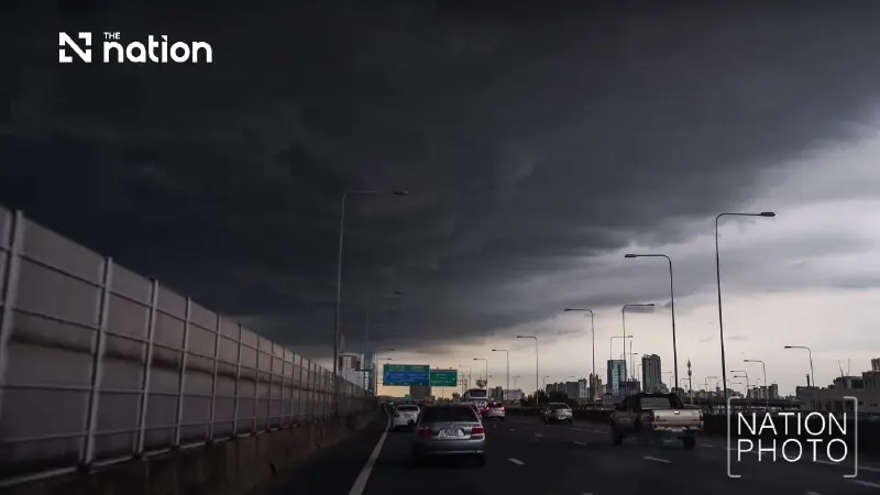


The Thai Meteorological Department warns of heavy to very heavy rain and gusty winds from October 4-7, beginning in the North and Northeast before spreading to other regions.
- The Thai Meteorological Department has issued a warning for heavy rain, thundershowers, and strong winds across much of Thailand from October 4 to 7 .
- The adverse weather will affect different regions on different days, starting in the North and Northeast before spreading to the Central, Eastern, and Southern regions.
- Residents are warned of potential flash floods, particularly in low-lying areas, while mariners are advised to be cautious of waves exceeding two metres.
The Thai Meteorological Department (TMD) warned on Friday (October 2) that unstable weather would affect upper Thailand from October 4-7, bringing thundershowers, gusty winds and isolated heavy to very heavy rain.
The warning was contained in the department’s third notice, issued at 5pm, with affected areas expected to shift between regions during the four-day period.
Rain to spread from North and Northeast
On October 4, the main areas at risk are the upper and eastern parts of the North and the Northeast.
On October 5-6, unsettled conditions are forecast to spread to the North, the Central region, including Bangkok and surrounding provinces, the East and the upper South. Rainfall in the Northeast is expected to decrease during this period.
On October 7, the main areas affected are expected to be western parts of the North and Central region, as well as the South, while rainfall is forecast to ease elsewhere.
As the rainy season approaches its end, a high-pressure system or cold air mass from China is expected to extend over the North and upper Northeast, triggering thundershowers during the initial period.
At the same time, the southwest monsoon will continue to prevail over the Andaman Sea, the South and the Gulf of Thailand.
Flash flood and strong-wind warning
The TMD urged people to be alert for thundershowers, gusty winds, heavy rain and accumulated rainfall that could trigger flash floods and run-off.
Particular caution is advised in foothill areas near waterways and in low-lying locations, where flooding may persist. People should also avoid open areas, large trees and unstable billboards during thunderstorms.
Winds and waves in the Andaman Sea and Gulf of Thailand are expected to strengthen, with waves rising above two metres in areas experiencing thundershowers. Mariners should check sailing routes, proceed with caution and avoid areas affected by thunderstorms.
Heavy rain to persist in East and South
The East and South are expected to see continued rain from October 8-12, with isolated heavy to very heavy rain possible.
The department urged residents to closely follow weather updates during this period. People were also advised to plan daily activities and travel carefully to reduce potential risks.
Weather information is available through the Thai Meteorological Department website and its hotlines at 0-2399-4012-13 and 1182, which operate 24 hours a day. The next notice is scheduled for 5am on October 3.

Lower South faces heavy rain in 24-hour forecast
For the next 24 hours, the lower Northeast, the East and the Central region, including Bangkok and surrounding provinces, are forecast to experience thundershowers and gusty winds, with lightning possible in some areas.
The lower South is forecast to see isolated heavy rain.
These conditions are associated with southerly and southeasterly winds prevailing over central Thailand and the Gulf of Thailand.
In both the Andaman Sea and Gulf of Thailand, waves could exceed two metres in areas affected by thundershowers. Mariners should check routes, navigate carefully and avoid storm areas.
The TMD forecast for the period from 6pm on Friday to 6pm on Saturday is as follows:
- North: Thundershowers are forecast over 20% of the region, mainly in Tak, Kamphaeng Phet, Phichit and Phetchabun. Temperatures are expected to range from lows of 22-27C to highs of 33-37C.
- Northeast: Thundershowers are forecast over 40% of the region, with gusty winds in some areas, mainly in Chaiyaphum, Khon Kaen, Amnat Charoen, Nakhon Ratchasima, Buri Ram, Surin, Si Sa Ket and Ubon Ratchathani. Temperatures are expected to range from lows of 23-26C to highs of 34-36C.
- Central region: Thundershowers are forecast over 40% of the region, with gusty winds in some areas, mainly in Kanchanaburi, Ratchaburi, Nakhon Pathom, Samut Sakhon, Samut Songkhram, Ayutthaya, Lop Buri and Saraburi. Temperatures are expected to range from lows of 23-27C to highs of 35-37C.
- East: Thundershowers are forecast over 40% of the region, with gusty winds and isolated heavy rain in Sa Kaeo, Chachoengsao, Chonburi, Rayong, Chanthaburi and Trat. Temperatures are expected to range from lows of 24-27C to highs of 32-35C.
- South, east coast: Thundershowers are forecast over 40% of the region, with isolated heavy rain in Surat Thani, Nakhon Si Thammarat, Songkhla, Yala and Narathiwat. Temperatures are expected to range from lows of 23-25C to highs of 33-35C.
- South, west coast: Thundershowers are forecast over 60% of the region, with isolated heavy rain in Krabi, Trang and Satun. Temperatures are expected to range from lows of 23-26C to highs of 32-35C.
- Bangkok and surrounding provinces: Thundershowers are forecast over 40% of the area, with gusty winds in some locations. Temperatures are expected to range from lows of 26-28C to highs of 34-36C.
