
Thailand forecasts unsettled weather and heavy to very heavy rain
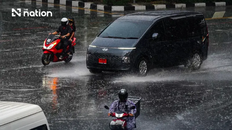


Thundershowers are forecast across 70% of Bangkok and surrounding areas, while rainfall is expected to ease in northern and northeastern Thailand.
- The Thai Meteorological Department has forecast unsettled weather for upper Thailand and parts of the South, including thundershowers, gusty winds, and heavy to very heavy rain.
- The public is warned of potential flash floods and runoff, particularly in foothill and low-lying areas, due to the heavy and accumulated rainfall.
- The Central, Eastern, and Southern regions, along with Bangkok, are expected to be most affected, with a 70% chance of thundershowers and heavy rain in many provinces.
- Mariners are advised to navigate with caution and avoid thundershower areas in the Andaman Sea and Gulf of Thailand, where waves may exceed 2 meters.
The Thai Meteorological Department’s 24-hour forecast issued on Sunday (October 11, 2026) indicates continued unsettled weather in upper Thailand, with thundershowers, gusty winds, isolated heavy to very heavy rain and possible lightning strikes.
Parts of the South are also expected to experience heavy to very heavy rain, while rainfall in the Northeast and North is forecast to decrease.
People are advised to beware of heavy to very heavy rain and accumulated rainfall, which could cause flash floods and sudden runoff, particularly on foothill slopes near waterways and in low-lying areas.
Waterlogging is also possible in low-lying locations.

A high-pressure system, or cold air mass, from China has extended over the North, Northeast and South China Sea.
Meanwhile, easterly and southeasterly winds are carrying moisture from the South China Sea into the lower Northeast, East and upper Gulf of Thailand, while a monsoon trough lies over the Gulf and the South.
In the Andaman Sea and Gulf of Thailand, waves are expected to exceed 2 metres in areas with thundershowers.
Mariners should navigate with caution and avoid sailing through these areas.
Regional forecast
The department’s forecast covers Thailand from 6am on Sunday to 6am on Monday.
North
- Thundershowers across 40% of the region, accompanied by gusty winds.
- Isolated heavy rain in Tak and Kamphaeng Phet.
- Minimum temperatures: 20–25°C.
- Maximum temperatures: 32–36°C.
- Easterly winds: 10–20 km/h.
Northeast
- Thundershowers across 30% of the region, accompanied by gusty winds, mainly in Khon Kaen, Chaiyaphum, Nakhon Ratchasima and Buri Ram.
- Minimum temperatures: 22–24°C.
- Maximum temperatures: 31–34°C.
- Northeasterly winds: 10–25 km/h.
Central region
- Thundershowers across 70% of the region, accompanied by gusty winds.
- Isolated heavy rain in Nakhon Sawan, Uthai Thani, Chai Nat, Phra Nakhon Si Ayutthaya, Suphan Buri, Nakhon Pathom and Samut Sakhon.
- Isolated very heavy rain in Kanchanaburi, Ratchaburi and Samut Songkhram.
- Minimum temperatures: 23–26°C.
- Maximum temperatures: 33–35°C.
- Easterly winds: 10–20 km/h.
East
- Thundershowers across 70% of the region, accompanied by gusty winds.
- Isolated heavy rain in Nakhon Nayok, Chachoengsao, Chon Buri, Rayong, Chanthaburi and Trat.
- Minimum temperatures: 23–27°C.
- Maximum temperatures: 31–34°C.
- Easterly winds: 15–30 km/h.
- Waves: around 1 metre high, exceeding 2 metres in areas with thundershowers.
South (east coast)
- Thundershowers across 70% of the region.
- Isolated heavy rain in Chumphon, Surat Thani, Nakhon Si Thammarat, Pattani, Phatthalung, Songkhla, Yala and Narathiwat.
- Isolated very heavy rain in Phetchaburi and Prachuap Khiri Khan.
- Minimum temperatures: 22–25°C.
- Maximum temperatures: 31–34°C.
- Variable winds: 15–30 km/h.
- Waves: around 1 metre high, exceeding 2 metres in areas with thundershowers.
South (west coast)
- Thundershowers across 60% of the region.
- Isolated heavy rain in Ranong, Phang Nga, Phuket, Krabi, Trang and Satun.
- Minimum temperatures: 23–25°C.
- Maximum temperatures: 32–34°C.
- Northwesterly winds: 15–30 km/h.
- Waves: around 1 metre high, exceeding 2 metres in areas with thundershowers.
Bangkok and surrounding areas
- Thundershowers across 70% of the area, accompanied by gusty winds.
- Isolated heavy rain.
- Minimum temperatures: 25–27°C.
- Maximum temperatures: 32–34°C.
- Northeasterly winds: 10–20 km/h.
