
I am looking to climb Mt Kinabatu at the end of June and I am trying to figure out how exactly to pr


Play
Is it a good time to climb the mountain and how big are the climbing groups organised by local travel operators? Thanks for the help. Cindy
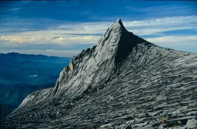
Mt Kinabalu, the tallest mountain in Southeast Asia, is in the Kinabalu National Park in the province of Sabah in Malaysian Borneo. Thousands of tourists visit Kinabalu National Park every year and they all come with the aim of climbing Mt Kinabalu. The recommended climbing season is usually from late February to July though it’s best to climb in the dry season around March and April. At the end of June, the rains on Kinabalu can be fairly unpredictable and they can still occur during that time.
You should bring with you your personal belongings in a light backpack. Necessary items are a raincoat, hat, money, torchlight, sun lotion, tissues/toilet roll, water bottle and some food and drink. If you have a porter, remember to have your bag inside a few layers of plastic bags in case it rains.
As it's in the National Park territory, you will need a park permit to climb Mt Kinabalu. This can be organised through the National Park or a travel agency. The simplest way is to contact your local travel agent, who will be able to offer you a selection of different packages to climb Mt Kinabalu. There are a number of tour groups that operate well-run tours of the mountain for two or three nights. Booking through a travel agent, it's likely there might be up to 10 or 12 people in your group, with two guides. Most travel agents will be able to provide a package that includes accommodation on Laban Rata, as well as all the fees for climbing and guides.
Climbing the mountain is quite easy. It usually takes just two days and is possible even for beginners with a reasonable level of fitness. Hope you enjoy the trip!
Which is the closest beach to Yangon worth visiting? How long does it take to get there by car? I have very limited time in the beginning of July, so the closer the better for me. Thanks a lot, YY
Myanmar has a pretty long coastline of about 2,000 kilometres, but the nearest one to Yangon is Let-Khok-Kone Beach. It is located only 30 km from Yangon and is thus a popular weekend picnic spot for local people. The beach can be reached by a ferry ride to Dallah followed by a 3 hours' drive. This beach can get very busy on public holidays. The nearest beach is not as pretty and peaceful as those beaches along the western coast on the Bay of Bengal.
Beach destinations from the south to north along the west coast are Ngwe Saung, Chaung Thar, Kanthaya and Ngapali Beach. There are also a few other resorts opening soon in southern Myanmar, such as Maungmagan on the Andaman Sea . This area and the Myeik Archipelago are still not easily accessible, but are very pristine.
Ngwe Suang Beach and Chaung Thar Beach can be reached by car within five hours from Yangon. They have long coastlines facing the Bay of Bengal with unspoilt white sandy beaches and clean and clear water. The most attractive and popular is Ngapali Beach, which can be reached by plane. The daily flight from Yangon takes an hour.
However, the best time to visit Myanmar’s beaches is from November to April, since the monsoon hits the entire coastline from June to September. Today, many seaside resorts operate in the low season as they receive more bookings from tourists. Just keep up with the weather forecast, and enjoy the peace and quiet in the low season by the Bay of Bengal!
