
River deep, mountain high


Play
France's Grand Canyon offers a wild walk where the river carved a gap in the mountain
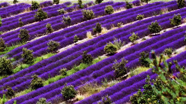
The vertiginous scent from the distant lavender fields in full bloom adds to the surprise of staring 300 metres down into the abyss of France’s Gorge of Verdon.
The view down the cliff from the Maugue viewing point is also fascinating, as it offers the chance to see the surging waters of the Verdon river which created this wonder of nature.
The gorge is known as the Grand Canyon of France and was created over aeons of time as the Verdon river carved a path through a mountain. It is up to 700 metres deep in places.
Located in the region of Provence, not far from Nice, the gorge is one of the largest and most beautiful canyons in Europe. The Verdon has its source in the French Alps, fed by lakes at an altitude of 2,500 metres and winds its way for 160 kilometres before flowing into the Durance River, then into the Mediterranean.
For a 21-kilometre stretch between Castellane and Lac de Sainte-Croix, the wild Alpine river has created not only one of Europe’s most imposing gorges but also a landscape that has been preserved as a national park since 1997.
The gorge’s beauty has been drawing adventurers for over a century, among them French hydro-geologist Edouard-Alfred Martel, who led a dangerous and difficult expedition along the bottom of the gorge taking several days in the summer of 1905.
With its narrow passages and steep steps, the walking trail, approximately 14 kilometres long is still a challenge to complete today. Once the descent deep into the gorge has begun, there is no turning back.
Decent footwear, ample provisions and a functioning pocket torch are essential for any trip down the gorge, with the hike taking approximately six hours.
The trail was named the Sentier Blanc-Martel in 2005, in honour of Isidore Blanc, the guide for expedition, and Martel, its leader.
Today the Verdon has been tamed by five dams that now control and regulate its dangerous torrents.
As well as Lac de Castillon, which is situated upstream, there is the Sainte-Croix – the second largest man-made reservoir in France - situated at the gorge’s exit.
The lake, with bright blue water from all the glacial flour mixed in to it, is best viewed from the Sainte-Croix bridge, which crosses the Verdon on 45-metre-high piers.
Although rightfully described as the most beautiful lake in Provence, it was created in an ugly way: over 2,000 hectares of fertile land had to be flooded and an entire village destroyed to create Lac de Sainte-Croix.
The village of Les-Salles-sur-Verdon was rebuilt in the same style as the old around 400 metres away on higher ground, with the old bells still tolling each day for the Angelus in the new church.
The village of Moustiers-Sainte-Marie is located around four kilometres above the lake and with its narrow alleys, stone houses and the mountain stream that divides it in two, is considered one of the jewels of Provence.
The village of approximately 700 inhabitants is home to a largely Romanesque church.
It was built at the foot of a rocky outcrop on the site of a fifth-century monastery. High above the village is the 12th-century chapel of Notre-Dame-de-Beauvoir, a pilgrimage site reached by a steep path.
The walk is well worth the effort as from here it possible not only to enjoy the red-tiled roofs, cypress trees and gnarled olive groves of Moustiers-Sainte-Marie but also the surrounding countryside.
For visitors beginning their route to the Gorge of Verdon from Moustiers-Sainte-Marie, this is a beautiful appetiser for what lies ahead. For those ending their dizzying canyon tour, the vista is a enduring reminder of a stunning trip through deepest Provence.
