
Bangkok faces heavy rain as storms forecast across 80% of area
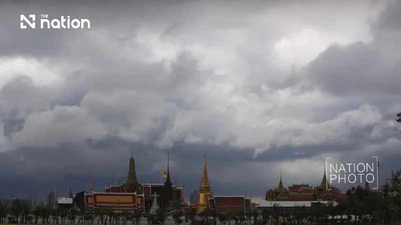


Western central Thailand faces heavy to very heavy rain, with warnings of flash floods, overflowing rivers, forest run-off and landslides.
- Thunderstorms are forecast across 80% of Bangkok and its surrounding provinces, bringing heavy to very heavy rain.
- The Thai Meteorological Department warns that the downpours could worsen existing flooding and potentially trigger flash floods, overflowing rivers, and landslides.
- Residents are advised to be cautious and avoid routes prone to recurring floods, particularly in low-lying areas.
- The severe weather is caused by a low-pressure area over the Central region combined with a strong southwesterly monsoon.
Rain arrived early on Sunday (September 27, 2026), with the Thai Meteorological Department (TMD) warning that heavy downpours could worsen flooding in Bangkok.
Thunderstorms are forecast across 80% of Bangkok and surrounding provinces.
Over the next 24 hours, many areas in the western part of the Central region are expected to have heavy rain, with very heavy rain in some places.
Rainfall is beginning to ease in Bangkok and surrounding provinces and in the East, but rain will continue, with heavy downpours in some areas.
People should beware of heavy to very heavy rain and accumulated rainfall, which could trigger flash floods, cause floodwater to build up and rivers to overflow, and lead to forest run-off and landslides, particularly on foothill slopes near waterways and in low-lying areas.

They should avoid routes prone to recurring flooding, especially in low-lying areas where temporary waterlogging is possible.
The conditions are being driven by a low-pressure area over the western part of the Central region, together with a fairly strong southwesterly monsoon over the Andaman Sea, the South and the Gulf of Thailand.
The upper Andaman Sea and upper Gulf of Thailand are experiencing fairly strong winds and waves of 2–3 metres, rising above 3 metres in thunderstorms.
Mariners in the Andaman Sea and Gulf of Thailand should navigate with caution and avoid thunderstorm areas.
Small boats in the upper Andaman Sea and upper Gulf of Thailand should remain ashore until Monday (September 28).
Thailand forecast from 6am on Sunday (September 27) to 6am on Monday (September 28)
Bangkok and surrounding provinces
- Thunderstorms are expected across 80% of the area, with heavy rain in some places.
- Minimum temperatures: 24–25°C
- Maximum temperatures: 27–29°C
- Variable winds at 10–25km/h.
North
- Thunderstorms are expected across 60% of the region, with heavy rain in parts of Sukhothai, Phitsanulok, Phichit and Phetchabun, and very heavy rain in parts of Tak and Kamphaeng Phet.
- Minimum temperatures: 23–25°C
- Maximum temperatures: 31–36°C
- Easterly winds at 10–20km/h.
Northeast
- Thunderstorms are expected across 60% of the region, with heavy rain in parts of Chaiyaphum, Nakhon Ratchasima and Buri Ram.
- Minimum temperatures: 23–25°C
- Maximum temperatures: 29–34°C
- Easterly winds at 10–25km/h.
Central region
- Thunderstorms are expected across 80% of the region, with heavy rain in parts of Chai Nat, Lop Buri, Saraburi, Sing Buri, Ang Thong, Phra Nakhon Si Ayutthaya, Nakhon Pathom, Samut Sakhon and Samut Songkhram. Very heavy rain is expected in parts of Nakhon Sawan, Uthai Thani, Suphan Buri, Kanchanaburi and Ratchaburi.
- Minimum temperatures: 22–25°C
- Maximum temperatures: 27–31°C
- Variable winds at 10–25km/h.
East
- Thunderstorms are expected across 70% of the region, with heavy rain in parts of Prachin Buri, Sa Kaeo, Chachoengsao, Chon Buri and Rayong, and very heavy rain in parts of Nakhon Nayok, Chanthaburi and Trat.
- Minimum temperatures: 23–25°C
- Maximum temperatures: 26–28°C
- Variable winds at 20–40km/h.
- Waves of 2–3 metres, exceeding 3 metres in thunderstorms.
South (east coast)
- Thunderstorms are expected across 60% of the region, with heavy rain in parts of Chumphon and Surat Thani, and very heavy rain in parts of Phetchaburi and Prachuap Khiri Khan.
- Minimum temperatures: 21–24°C
- Maximum temperatures: 28–34°C
- From Surat Thani northwards: northwesterly winds at 20–35km/h, with waves of about 2 metres, exceeding 3 metres in thunderstorms.
- From Nakhon Si Thammarat southwards: westerly winds at 15–35km/h, with waves of 1–2 metres, exceeding 3 metres in thunderstorms.
South (west coast)
- Thunderstorms are expected across 70% of the region, with heavy rain in parts of Ranong, Phang Nga, Phuket and Krabi.
- Minimum temperatures: 23–26°C
- Maximum temperatures: 28–35°C
- From Phang Nga northwards: westerly winds at 20–40km/h, with waves of 2–3 metres, exceeding 3 metres in thunderstorms.
- From Phuket southwards: southwesterly winds at 15–35km/h, with waves of 1–2 metres, exceeding 2 metres in thunderstorms.
