
Magnitude 7.7 quake hits Indonesia, killing at least two
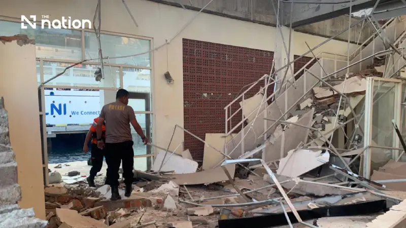


A magnitude 7.7 earthquake struck off Flores in eastern Indonesia, killing at least two people before authorities lifted a tsunami warning
A magnitude 7.7 earthquake struck off Indonesia’s Flores region early Saturday, killing at least two people, damaging buildings and prompting a tsunami warning that was later lifted.
The earthquake struck at 5.58am local time at a shallow depth of 10 kilometres, with its epicentre about 68 kilometres north-northwest of Ende in East Nusa Tenggara province, according to the US Geological Survey figures reported by Associated Press.
Reuters initially reported the earthquake at magnitude 6.9, citing the European-Mediterranean Seismological Centre, which also placed the depth at 10 kilometres.

At least two dead as buildings collapse
Preliminary reports from the Maumere Search and Rescue Agency recorded at least two deaths and two injuries, according to Indonesia’s disaster management agency.
Homes and other buildings were damaged or collapsed in the affected area, including in Maumere and Sikka, as residents fled during the strong shaking. Hospitals also moved some patients outdoors as authorities assessed the impact.
Several aftershocks followed the main earthquake.

Indonesia has experienced repeated strong earthquakes because it lies along the seismically active Pacific Ring of Fire.
Tsunami warning lifted
Indonesia’s Meteorology, Climatology and Geophysics Agency issued a tsunami warning after the offshore earthquake.

The warning was later lifted after monitoring showed no significant rise in sea levels that would pose a threat to coastal communities.
The earthquake struck the Flores region, which has previously suffered destructive earthquakes and tsunamis, including a major disaster in 1992.
Authorities were continuing to assess damage and the effects of aftershocks following Saturday’s earthquake.

