
RID Issues Flood Alert for 11 Provinces as Chao Phraya Rises
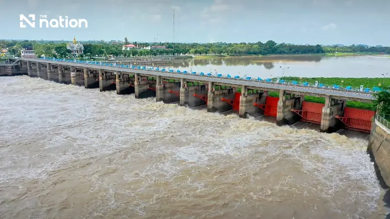


The Royal Irrigation Department warns 11 provinces to prepare for rising river levels as Chao Phraya Dam discharges increase due to northern runoff
- The Royal Irrigation Department (RID) has issued a flood warning for 11 provinces in the Chao Phraya Basin.
- The alert is due to increased northern runoff, which is forcing the Chao Phraya Dam to increase its downstream water discharge.
- The increased discharge is expected to raise downstream river levels by 0.60 to 1.50 meters.
- Low-lying areas situated outside of permanent flood embankments, particularly in Ayutthaya province, are at the highest risk of flooding.
The Royal Irrigation Department warns 11 provinces to prepare for rising river levels as Chao Phraya Dam discharges increase due to northern runoff.
The Royal Irrigation Department (RID) has issued its second official flood warning, cautioning authorities and residents across 11 central provinces in the Chao Phraya Basin to prepare for rising river levels as northern runoff continues to surge.
Following an analysis of hydrological data by the Smart Water Operation Centre (SWOC) on 18 September 2026, officials confirmed a steady increase in water flowing from upper regions into the reservoir area above the Chao Phraya Dam.
To manage incoming volumes, the department is adjusting its water management plan and increasing discharge rates downstream.
As of 06:00 on 18 September, the C.2 measuring station in Nakhon Sawan recorded a flow rate of 963 cubic metres per second. Predictive models forecast that flow rates at Station C.2 will reach 1,100 to 1,250 cubic metres per second by 27 September.
Combined with an additional 50 to 100 cubic metres per second expected from tributary rivers, total water volume above the Chao Phraya Dam is projected to reach between 1,150 and 1,350 cubic metres per second.

Impact on Downstream Communities
To control upstream reservoir levels and absorb incoming floodwaters, the RID must increase downstream discharges through the Chao Phraya Dam to between 700 and 1,000 cubic metres per second.
The rate will be continuously adjusted to match real-time inflows.
The increased discharge will elevate water levels downstream by 0.60 to 1.50 metres above present levels, stretching from Chai Nat Province through to Phra Nakhon Si Ayutthaya Province.
Low-lying areas situated outside permanent flood embankments face the highest risk—particularly within the Sena, Phak Hai, Bang Ban, Phra Nakhon Si Ayutthaya, Bang Pa-in, and Bang Sai districts of Ayutthaya.
Communities situated within protected dike systems currently remain safe from flooding.
The RID noted that should northern runoff force discharge rates to exceed 1,000 cubic metres per second, further situational updates will be issued immediately.

Basin-Wide Mitigation Strategy
Irrigation officials are regulating flows across both the East and West Bank canal networks to optimise system capacity.
Water operations teams are continuously analysing rainfall data, runoff patterns, and predictive modelling to limit the impact on residential and agricultural areas.
Governors across all 11 Chao Phraya Basin provinces and regional emergency services have been instructed to ensure operational readiness and disseminate public warnings.
Residents living in low-lying, riverside, and unprotected areas downstream of the dam are advised to monitor official RID bulletins closely and prepare for fluctuating water conditions.
