
Chao Phraya water levels expected to rise in four Thai provinces
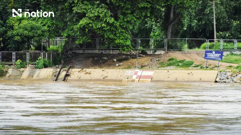


The Department of Disaster Prevention and Mitigation warns low-lying areas outside flood embankments in four provinces to prepare for a 0.70–1.70-metre rise in water levels.
- The Department of Disaster Prevention and Mitigation (DDPM) has warned that water levels in the Chao Phraya River are expected to rise in four provinces: Phra Nakhon Si Ayutthaya, Ang Thong, Sing Buri, and Chai Nat.
- The rise is caused by an increased discharge of 1,500–2,000 cubic metres per second from the Chao Phraya Dam, which is projected to raise water levels by 0.70 to 1.70 metres in low-lying areas.
- In response, disaster management agencies are preparing machinery and personnel, and have advised residents in at-risk areas to monitor water levels and prepare to move belongings to higher ground.
- The warning also extends to relevant agencies and residents along the Chao Phraya River in Bangkok, who are being alerted to prepare for the situation.
The Department of Disaster Prevention and Mitigation (DDPM) warned on Thursday (September 24, 2026) that water levels in the Chao Phraya River were expected to rise, particularly in low-lying areas outside flood embankments in four provinces: Phra Nakhon Si Ayutthaya, Ang Thong, Sing Buri and Chai Nat.
The at-risk districts are:
- Phra Nakhon Si Ayutthaya: Sena, Phak Hai, Bang Ban, Phra Nakhon Si Ayutthaya, Bang Pa-in and Bang Sai.
- Ang Thong: Wiset Chai Chan, Pa Mok, Chaiyo and Mueang Ang Thong.
- Sing Buri: In Buri and Phrom Buri.
- Chai Nat: Sapphaya.
In addition to the at-risk areas in the four provinces, DDPM has coordinated with the Bangkok Metropolitan Administration (BMA) to alert relevant agencies, operators conducting business on the river and residents along both banks of the Chao Phraya to prepare for the water situation.
It has also instructed DDPM regional centres to ready disaster-response machinery, operational vehicles and personnel to support assistance to residents around the clock.
Theerapat Katchamat, director-general of DDPM, said the department, acting as the central disaster prevention and mitigation authority, had received a notification from the Royal Irrigation Department (RID) on the Chao Phraya Basin water situation, dated September 22.
The notification forecast water flows over the following 1–9 days.
It said flow at station C.2 in Mueang Nakhon Sawan district, Nakhon Sawan province, would peak at about 1,800 cubic metres per second on September 23, with a further 300–400 cubic metres per second expected from tributaries.
Those flows would bring the upstream flow at the Chao Phraya Dam to about 2,100–2,200 cubic metres per second.
With 400–450 cubic metres per second being diverted into irrigation systems on both sides, it would be necessary to discharge 1,500–2,000 cubic metres per second downstream of the dam.
This was expected to raise water levels by about 0.70–1.70 metres in low-lying areas outside flood embankments.
DDPM orders regional centres to prepare and monitor closely
To prepare for the expected rise in water levels and reduce impacts on residents, DDPM instructed Regional Centres 1 in Pathum Thani, 2 in Suphan Buri and 16 in Chai Nat to convene their War Room working groups to monitor weather and water conditions.
The centres were also told to prepare disaster-response machinery, operational vehicles and personnel to support provinces within their areas of responsibility around the clock.
If assessments indicate that a disaster is likely or that the situation is spreading more widely, officials and Emergency Response Teams (ERT), together with machinery and operational vehicles, are to be deployed to provincial incident command centres.
They are to coordinate with provincial DDPM offices and support the establishment and management of temporary shelters.
If resources are insufficient, support is to be requested from nearby DDPM regional centres.
Residents in low-lying areas outside flood embankments are also to be informed to monitor water levels and prepare to move belongings to higher ground out of the flood zone for safety.
