
Heavy rain forecast for Bangkok and central Thailand according to TMD
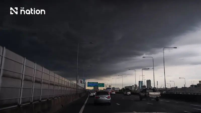


Thundershowers are forecast over 70% of central Thailand and 60% of Bangkok and nearby areas, with farmers urged to check drainage and guard against disease.
- The Thai Meteorological Department (TMD) has forecast isolated heavy rain for Bangkok and the Central region within the next 24 hours.
- This weather pattern is caused by a high-pressure system from China pushing moist easterly and southeasterly winds over Thailand.
- Residents are warned of potential flash floods and runoff, particularly in low-lying areas and near waterways.
- The forecast specifies a 70% chance of thundershowers for the Central region and a 60% chance for Bangkok and its surrounding areas.
The Thai Meteorological Department (TMD) forecasts isolated heavy rain in Thailand over the next 24 hours, particularly in the lower North, the Central region including Bangkok and nearby areas, the East and the South.
Residents in these areas should beware of heavy and accumulated rainfall that could cause flash floods and sudden runoff from higher ground, especially near waterways at the foot of hills and in low-lying areas.
A high-pressure system, or cold air mass, from China continues to cover the North, the Northeast and the South China Sea.
This is bringing easterly and southeasterly winds that carry moisture from the South China Sea over Thailand and the Gulf of Thailand.
Waves in the Andaman Sea and the Gulf of Thailand are forecast to exceed 2 metres in areas with thundershowers.
Mariners should check their routes, navigate with caution and avoid sailing through these areas.
Agricultural forecast advises farmers to prepare for rain during October 14–20
In its agricultural forecast, the TMD expects thundershowers and isolated heavy rain in the western parts of the North and the Central region, and in the East, from Wednesday (October 14, 2026) to Friday (October 16).
Rainfall in upper Thailand is expected to decrease during October 17–20, while the South continues to experience rain, with heavy to very heavy falls in some areas.
Farmers in western Thailand, the East and the South should prepare for rain, check drainage systems and take precautions against crop and livestock diseases associated with high humidity.
Thailand weather forecast from 6pm on October 14 to 6pm on October 15
North
- Thundershowers are forecast over 30% of the region, with isolated heavy rain in Tak, Kamphaeng Phet and Phetchabun.
- Minimum temperatures are expected at 21–26°C and maximum temperatures at 33–36°C, with easterly winds of 10–20 km/h.
Northeast
- Thundershowers are forecast over 30% of the region, mainly in Loei, Chaiyaphum, Nakhon Ratchasima, Buri Ram, Surin, Si Sa Ket and Ubon Ratchathani.
- Minimum temperatures are expected at 22–25°C and maximum temperatures at 33–34°C, with easterly winds of 10–25 km/h.
Central
- Thundershowers are forecast over 70% of the region, with isolated heavy rain in Nakhon Sawan, Uthai Thani, Chai Nat, Suphan Buri, Phra Nakhon Si Ayutthaya, Kanchanaburi, Ratchaburi, Nakhon Pathom, Samut Sakhon and Samut Songkhram.
- Minimum temperatures are expected at 23–26°C and maximum temperatures at 33–36°C, with southeasterly winds of 10–20 km/h.
East
- Thundershowers are forecast over 60% of the region, with isolated heavy rain in Chachoengsao, Sa Kaeo, Chon Buri, Rayong, Chanthaburi and Trat.
- Minimum temperatures are expected at 24–26°C and maximum temperatures at 31–35°C, with southeasterly winds of 10–30 km/h.
- Waves are expected to remain below 1 metre, exceeding 2 metres in areas with thundershowers.
South (east coast)
- Thundershowers are forecast over 60% of the region, with isolated heavy rain in Phetchaburi, Prachuap Khiri Khan, Chumphon, Surat Thani and Nakhon Si Thammarat.
- Minimum temperatures are expected at 22–25°C and maximum temperatures at 30–35°C, with southeasterly winds of 15–30 km/h.
- Waves are expected at about 1 metre, exceeding 2 metres in areas with thundershowers.
South (west coast)
- Thundershowers are forecast over 60% of the region, with isolated heavy rain in Phang Nga, Krabi and Trang.
- Minimum temperatures are expected at 23–25°C and maximum temperatures at 31–35°C, with easterly winds of 15–30 km/h.
- Waves are expected at about 1 metre, exceeding 2 metres in areas with thundershowers.
Bangkok and nearby areas
- Thundershowers are forecast over 60% of the area, with isolated heavy rain.
- Minimum temperatures are expected at 25–28°C and maximum temperatures at 33–35°C, with southeasterly winds of 10–20 km/h.
