
On the lava trail


Play
A unique tour lays bare the devastating power beneath Mount Merapi's beauty
It was around midnight on November 5, 2010 when terror struck the idyllic villages on the slopes of Mount Merapi in Yogyakarta.
After an anxious month watching the volcano’s grey plume grow larger and larger, on that fateful night, villagers suddenly faced the horror of a full-scale volcanic eruption.
A deadly ash cloud gushed forth from the mountain and heart-stopping thunderous roars were heard throughout the region. Red-hot dust and gravel filled the skies and rained down on the countryside.
The villagers panicked and ran to safety in the dark of night, chased by pyroclastic clouds that moved rapidly and burned everything in their path – trees, houses and fields.
In the morning, an eight-kilometre column of smoke could be seen rising high into the sky above Merapi’s peak. Villages were buried under tonnes of rock, sand and ash, with the charred carcasses of their livestock strewn across the countryside.
The human toll was devastating; 161 people died that night.
The 2010 disaster was the latest in a long line of recorded eruptions stretching back to 1548, and making Merapi one of the world’s most active volcanoes.
But thousands of people still live on the rumbling slopes, refusing to leave the fertile soil on which their livelihoods depend. Settlements exist as high as 1,700 metres above sea level, just four kilometres from the crater.
Earlier this month, I paid a visit to one of the villages destroyed in the 2010 eruption.
As I set foot in Ngrangkah, Cangkringan, I was welcomed by a cold, misty air.
I pitched my tent on land that was a bus station before it was destroyed and buried under the volcanic ash of Merapi.
Under a bright full moon and comforted by a warm bonfire, I spent my evening listening to locals’ stories about the many Merapi eruptions over the years.
Eventually, they told of how destroyed villages had been turned into tourism attractions by the uniquely-named Lava Tour.
The tour package offers the chance to explore the scenic beauty of the volcano while witnessing the effects of the 2010 eruption.
I woke a few hours before dawn the next day, eager to explore the mountain. The first destination was Njambu village – the perfect spot to enjoy sunrise over Mt Merapi.
The journey by jeep was over rugged terrain ribboned by a narrow dirt road. Along the way, the guide pointed out ruins of houses destroyed by eruptions, and a once densely-populated village now turned into a green expanse of shrubs and trees.
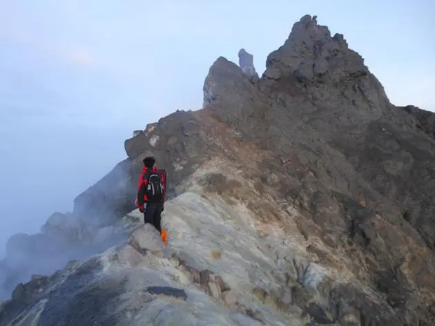
From Njambu, the trip continues to Kaliadem, where you can take a closer look at Merapi. If the weather is sunny, you can peek into the still-smouldering insides of the volcano.
We arrived at Petung village, where a home has been converted into a museum displaying the destructive force of Merapi’s eruptions. Among the objects on view are carcasses of livestock, burnt motorbikes and molten glass and bottles.
More poignant still is the variety of home furnishings that were melted by the heat of Merapi’s pyroclastic clouds.
But the thing that catches most visitors’ eyes is the wilted clock that hangs on the wall. Its hands are stopped at 12:04:42, the exact time when pyroclastic clouds laid waste to this house during the 2010 eruption.
