
Flood and landslide risks threaten 52 villages in four Thai provinces
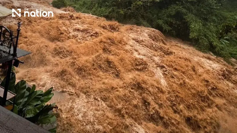


Thailand’s Department of Water Resources has placed 52 villages under flash-flood and landslide alerts, including eight communities in Chiang Rai under red alerts.
- Thailand's Department of Water Resources has issued a flash-flood and landslide warning for 52 villages across four provinces.
- The affected provinces are Chiang Rai, Nan, Trat, and Kanchanaburi, with alerts ranging from "watch" to "critical" levels.
- Chiang Rai is the most severely affected province, with 42 villages under alert, including all eight villages at the "critical" red-alert level.
- The increased risk is attributed to continuous heavy rainfall that has saturated the ground, indicated by a sharply rising soil moisture index.
The Department of Water Resources, under the Ministry of Natural Resources and Environment, has issued flash-flood and landslide warnings through its Early Warning System (EWS).
The department’s notice states that risks have been detected at 16 monitoring stations covering 52 villages in four provinces across Thailand. Residents in affected communities have been urged to check their local alert levels and prepare to respond without delay.
Chiang Rai faces the highest flood and landslide risk
According to the overall alert summary, 23 villages are at the watch level, 21 are at the preparedness level and eight are at the critical level.
Chiang Rai requires the closest monitoring, with 14 villages under watch, 20 at the preparedness level and eight at the critical red-alert level.
Nan has two villages under watch and one at the preparedness level, while three villages in Trat are at the preparedness level. Four villages in Kanchanaburi have been placed under watch.
Water Resources Office 1 reported continuing rain across 70% of northern Thailand, with heavy rainfall in some areas, particularly Mae Hong Son, Chiang Mai, Chiang Rai, Phayao, Nan and Tak.
The soil moisture index, or API, has risen sharply, indicating that the ground is becoming saturated. This increases the risk of flash floods and landslides in foothill communities and low-lying areas.
What each flood and landslide alert colour means
The Department of Water Resources has asked people in vulnerable areas to follow official guidance for each alert level.
At the watch level, shown in green, residents should closely monitor water conditions, news reports and announcements from government agencies.
At the preparedness level, shown in yellow, residents should gather essential supplies, including medicines, dried food and important documents. They should also plan evacuation routes and await further official warnings.
At the critical level, shown in red, residents should move their belongings and evacuate to a safe location immediately when instructed by officials.

How to monitor warnings in real time
People can check weather conditions, water levels and local warning signals around the clock through the Department of Water Resources’ online services.
Information is available through the Early Warning System website and the EWS DWR app, which is available for both iOS and Android devices.
