
Satellite flood risk widens across North and Northeast
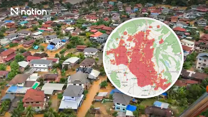


Check Nam data showed very-high-risk zones expanding while Sukhothai floods affected 89 villages and a reported 1,732 households.
Satellite-based flood-risk zones expanded across parts of northern and northeastern Thailand on Thursday (August 20, 2026), while confirmed flooding in Sukhothai affected three districts, 16 subdistricts and 89 villages.
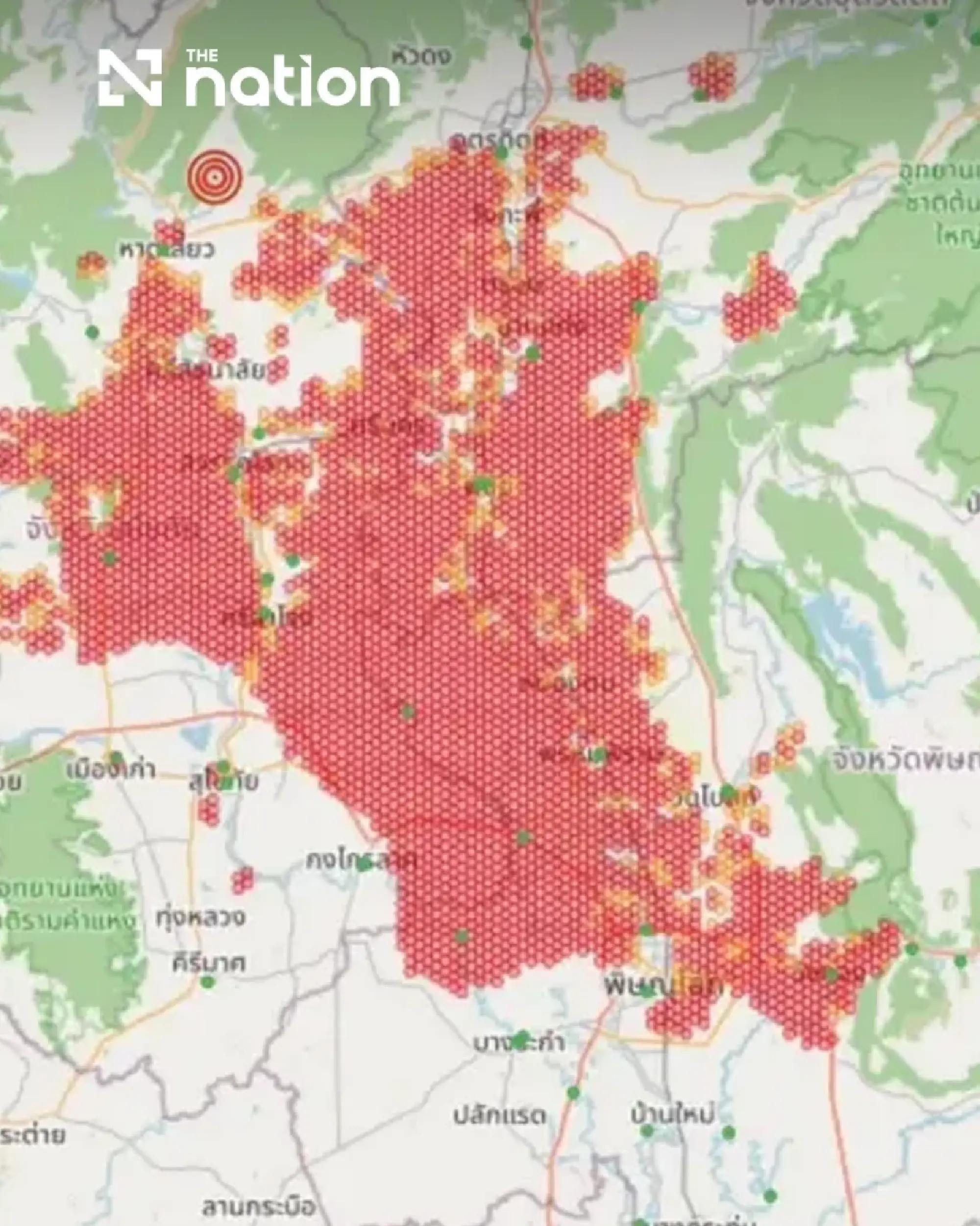
The Check Nam app, citing satellite imagery from the Geo-Informatics and Space Technology Development Agency (GISTDA), showed a marked expansion of areas classified as facing a “very high” flood risk at 3.33pm.
Dark-red risk zones were no longer concentrated around Mueang Sukhothai but formed a broad area extending across several districts and into neighbouring provinces.
Sukhothai authorities separately reported that flooding had affected 1,732 households, although the district-level figures supplied by the province add up to 1,731. Damage assessments were continuing, with no injuries or deaths reported in the preliminary information.
Dark-red zones extend through northern provinces
In Sukhothai, dense dark-red zones stretched from Si Satchanalai and Sawankhalok districts in the north through Mueang Sukhothai and southwards to Kong Krailat district.
The app also showed much of Phitsanulok as being at very high risk, particularly Phrom Phiram district and surrounding areas.
Red and yellow zones were beginning to appear across the provincial boundaries in southern Uttaradit and northern Phichit.
The risk map indicated areas requiring close monitoring rather than providing a confirmed count of inundated communities. The app said its analysis drew on GISTDA satellite imagery and was updated in real time.

Residents in risk areas were advised to:
Check water levels around their homes and identify evacuation routes.
Move valuables to higher ground and prepare emergency supplies.
Monitor floodwater movement, warning points and local conditions.
Stay away from hazardous areas and assist vulnerable family members.
Five upper northeastern provinces face high risk
The Check Nam update identified five provinces in the upper Northeast as facing the highest flood risk in the region.
Sakon Nakhon showed the broadest red zone, particularly around the Nong Han basin and central parts of the province.
Dense risk areas also appeared along the Mekong River and inland catchments in Nong Khai and Bueng Kan, indicating possible danger from overflowing waterways and flash floods.
In Nakhon Phanom, red zones extended along tributary basins in northern and central areas of the province.
Eastern Udon Thani also showed concentrated high-risk areas adjoining Nong Khai and Sakon Nakhon.
Further south, scattered red zones and yellow triangular warning symbols began appearing in parts of Kalasin, Mukdahan and Yasothon. Although the coverage was less extensive than in the upper northeastern provinces, the app advised continued close monitoring.

Sukhothai reports 89 villages affected
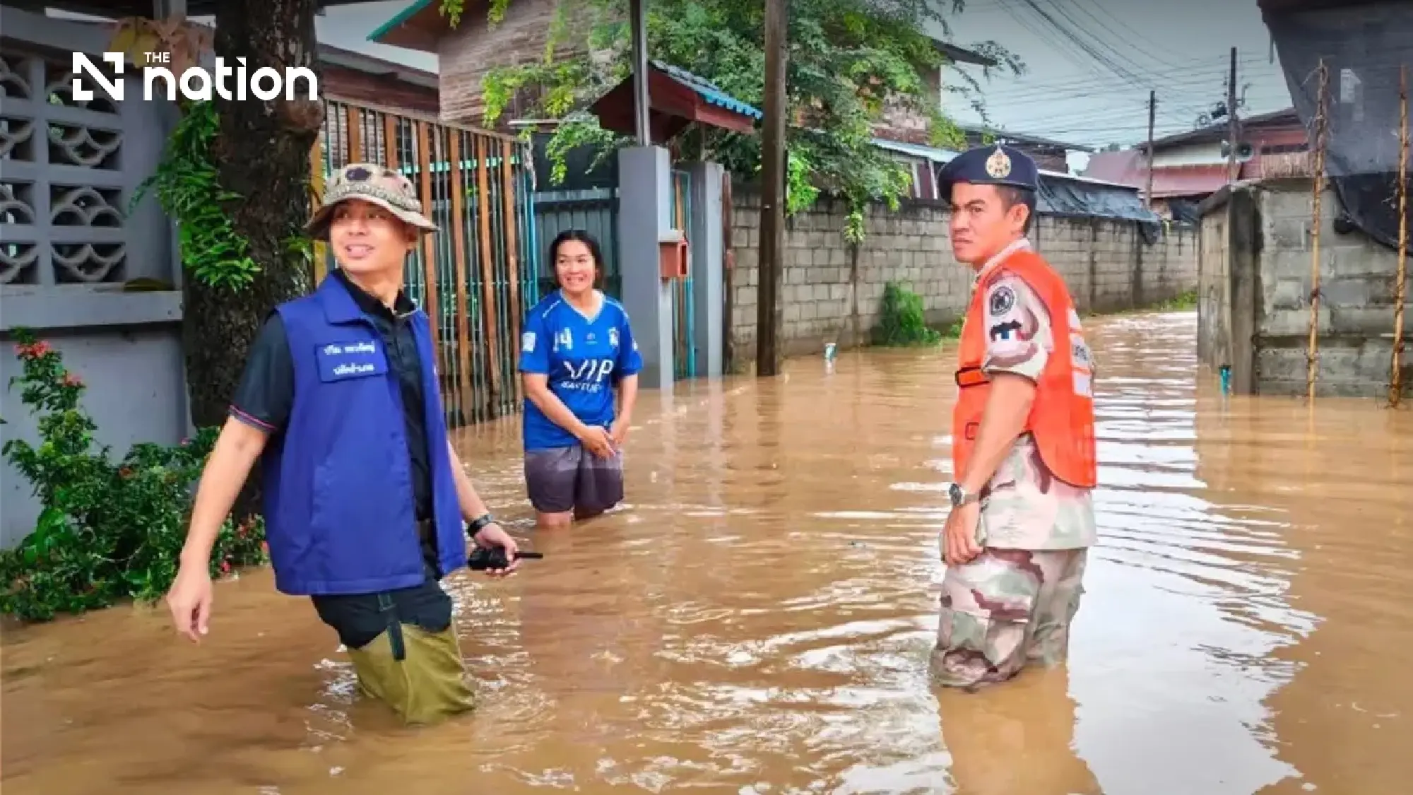
Sukhothai Governor Nopparit Sirikosol said heavy to very heavy rain from Wednesday into Thursday had caused run-off and flooding in several areas.
The province coordinated with the National Disaster Warning Centre under the Department of Disaster Prevention and Mitigation to issue a Cell Broadcast alert at 3.16am on Thursday.
The alert covered Si Satchanalai, Sawankhalok and Si Nakhon districts.
Residents were instructed to move belongings to higher ground, relocate vehicles, protect valuables and important documents, avoid electrical hazards and assist vulnerable people.
The preliminary district breakdown was:
- Si Satchanalai: Five subdistricts and 31 villages, affecting about 769 households. Agricultural damage was estimated at about 112 hectares, or 700 rai.
- Si Nakhon: Four subdistricts and 14 villages, affecting 104 households.
- Sawankhalok: Seven subdistricts and 44 villages, affecting 858 households.
The three district figures total 1,731 households, one fewer than the provincial total of 1,732 reported in the same update.
Relief teams deploy and temporary shelter opens
District authorities, local administrative organisations, subdistrict and village heads and other agencies continued providing assistance.
Operations included moving household items to higher ground, evacuating residents to safe areas and deploying machinery, vehicles, boats and rescue equipment.
Food, drinking water and other essential supplies were also being distributed.
Eight agencies were supporting the relief operation, while one temporary shelter was established at Wat Mon Kaeo in Ban Tuek subdistrict, Si Satchanalai district.
One person was staying at the shelter at the time of the update.
The Sukhothai Provincial Public Health Office deployed first-aid teams at Wat Ban Plai Na and Wat Mon Kaeo Subdistrict Health Promoting Hospital in Ban Tuek.
