
Bangkok and seven provinces on tidal flood alert until November 4
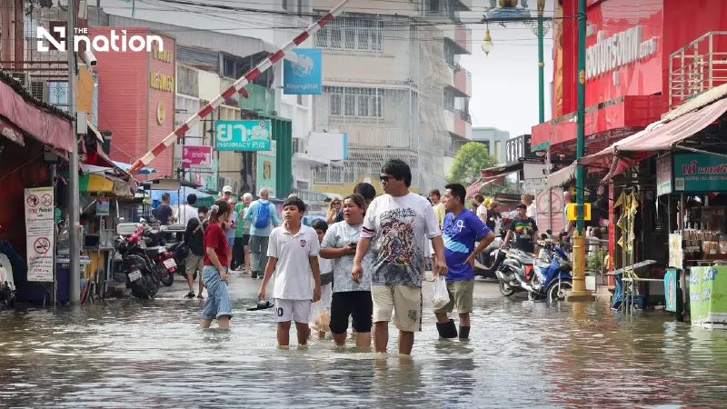


High tides could flood riverside communities and key roads in Bangkok and seven provinces during an alert running until November 4.
- A tidal flood alert is in effect for Bangkok and seven surrounding provinces until November 4.
- The alert is caused by a high-pressure system from China creating strong easterly winds, which are raising sea levels.
- Areas at risk include riverside communities along the Chao Phraya, Tha Chin, Bang Pakong, and Mae Klong rivers, particularly those outside flood defenses.
- Major roads that could be impacted by the high tides include Sukhumvit Road, Suksawat Road, and Rama II Road.
Bangkok and seven provinces face a risk of tidal flooding until November 4, 2026, with riverside communities, areas outside flood defences and major roads among the locations potentially affected.
The Office of the National Water Resources (ONWR) highlighted the risk in its national water report issued at 7am on November 1. The warning covers the period from October 31 to November 4.
The affected areas identified in the warning are Bangkok, Chachoengsao, Samut Prakan, Nonthaburi, Pathum Thani, Samut Sakhon, Nakhon Pathom and Samut Songkhram.
Four rivers and major roads at risk
Higher water levels could inundate areas along the Bang Pakong, Chao Phraya, Tha Chin and Mae Klong rivers, particularly communities outside flood embankments and locations without permanent flood protection.

The ONWR also identified Sukhumvit Road, Suksawat Road and Rama II Road as transport routes that could be affected.
Relevant agencies have been asked to closely monitor high tide conditions and prepare for rising water levels to reduce potential impacts on residents in vulnerable areas.
Easterly winds contribute to higher sea levels
The ONWR linked the conditions to a high-pressure system from China that has extended over upper Thailand and the South China Sea, bringing easterly winds across upper Thailand.

Stronger winds and waves are contributing to higher sea levels, with water levels at river mouths connected to the sea also expected to rise.
These conditions could allow water to flow into riverside communities and other unprotected areas during the warning period.
Unsettled weather forecast for November 2–6
The report also noted the possibility of thundershowers on November 1, particularly in the North, Northeast, Central region and South.

Unsettled conditions are forecast for November 2–6, with thundershowers, gusty winds and isolated heavy rain.
Regional rainfall maxima in the report were 68mm in Mae Hong Son in the North, 36mm in Loei in the Northeast and 96mm in Samut Sakhon in the Central region.
Trat recorded the highest rainfall in the East at 108mm, while Prachuap Khiri Khan in the West received 26mm and Phatthalung in the South recorded 62mm.
Reservoirs hold 82% of national storage capacity
Separately, the national water report put combined reservoir storage at 66,493 million cubic metres, equivalent to 82% of capacity. Usable water was reported at 42,367 million cubic metres, with a reported percentage of 75%.
Reservoirs in the North held 21,089 million cubic metres, or 76% of capacity. The Northeast had 8,329 million cubic metres, equivalent to 69%, while the Central region held 1,373 million cubic metres, or 73%.
In the East, storage stood at 2,824 million cubic metres, representing 89% of capacity. The West held 27,413 million cubic metres, or 97%, and the South had 5,465 million cubic metres, equivalent to 70%.
Among two major dams in the South, Rajjaprabha Dam held 4,273 million cubic metres, or 76% of capacity, while Bang Lang Dam contained 770 million cubic metres, equivalent to 53%.
