
Heavy rain lingers in upper Thailand as TMD flags rough seas
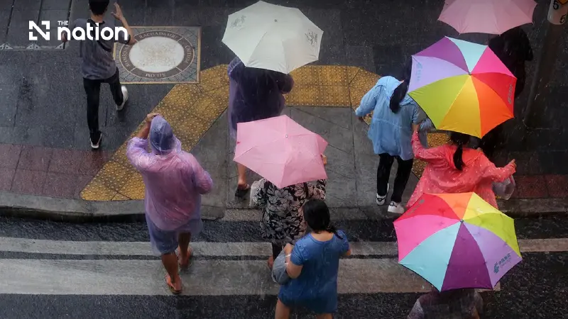


Thailand’s North, Northeast and East remain at risk of heavy rain, with Bangkok and nearby provinces forecast to see thunderstorms over 40 per cent of the area.
- The Thai Meteorological Department (TMD) forecasts continued heavy rain in upper Thailand, particularly affecting the North, Northeast, and East regions due to a low-pressure cell and a southwest monsoon.
- Warnings have been issued for rough seas in the Andaman Sea and the Gulf of Thailand, with waves expected to reach about 2 meters, and potentially higher in thunderstorm areas.
- Residents in the eastern Northeast and East are advised to be cautious of flash floods, while boat operators are urged to navigate carefully and avoid sailing in thunderstorm areas.
The Thai Meteorological Department (TMD) forecasts continued heavy rain across upper Thailand on Tuesday (July 7, 2026), with the Northeast expected to see thunderstorms over 60 per cent of the area and isolated heavy rain in some provinces.
Bangkok and its vicinity are forecast to have scattered thunderstorms.
In its 24-hour forecast, the TMD said the North, the Northeast and the East would continue to see isolated heavy rain, as a low-pressure cell covers upper Vietnam.
The moderate southwest monsoon also continues to prevail over the Andaman Sea, Thailand and the Gulf of Thailand.
People in the eastern part of the Northeast and in the East are advised to beware of heavy rain and accumulated rainfall, which could trigger flash floods and forest run-off, especially on foothill slopes near waterways and in low-lying areas.
Waves in the upper Andaman Sea and the upper Gulf of Thailand are forecast to be moderate, at about 2 metres high.
The lower Andaman Sea is expected to see waves of 1-2 metres, while waves in thunderstorm areas may rise above 2 metres.
Boat operators in the Andaman Sea and the Gulf of Thailand are advised to navigate with caution and avoid sailing in thunderstorm areas.
Weather forecast for Thailand from 6am on Tuesday (July 7, 2026) to 6am on Wednesday (July 8, 2026)
Bangkok and vicinity
- Thunderstorms are expected over 40 per cent of the area.
- Minimum temperature: 26-28°C
- Maximum temperature: 32-36°C
- Southwesterly winds: 10-25km/h
North
- Thunderstorms are expected over 40 per cent of the area, with isolated heavy rain in Mae Hong Son, Chiang Mai, Chiang Rai, Tak, Kamphaeng Phet and Phetchabun.
- Minimum temperature: 23-25°C
- Maximum temperature: 31-35°C
- Southwesterly winds: 10-20km/h
Northeast
- Thunderstorms are expected over 60 per cent of the area, with isolated heavy rain in Nong Khai, Bueng Kan, Udon Thani, Sakon Nakhon, Nakhon Phanom, Mukdahan, Chaiyaphum, Yasothon, Amnat Charoen, Surin, Si Sa Ket and Ubon Ratchathani.
- Minimum temperature: 23-25°C
- Maximum temperature: 29-35°C
- Southwesterly winds: 10-20km/h
Central region
- Thunderstorms are expected over 40 per cent of the area, mostly in Nakhon Sawan, Lop Buri, Saraburi, Kanchanaburi and Ratchaburi.
- Minimum temperature: 23-27°C
- Maximum temperature: 34-36°C
- Southwesterly winds: 10-25km/h
East
- Thunderstorms are expected over 60 per cent of the area, with isolated heavy rain in Nakhon Nayok, Prachin Buri, Sa Kaeo, Chon Buri, Rayong, Chanthaburi and Trat.
- Minimum temperature: 23-28°C
- Maximum temperature: 30-34°C
- Southwesterly winds: 20-35km/h
- Sea waves are expected to be about 2 metres high, rising above 2 metres in thunderstorm areas.
South, east coast
- Thunderstorms are expected over 30 per cent of the area, mostly in Surat Thani, Nakhon Si Thammarat, Yala and Narathiwat.
- Minimum temperature: 23-25°C
- Maximum temperature: 32-37°C
- From Surat Thani northwards: southwesterly winds of 20-35km/h. Sea waves are expected to be 1-2 metres high, rising above 2 metres offshore and in thunderstorm areas.
- From Nakhon Si Thammarat southwards: southwesterly winds of 15-30km/h. Sea waves are expected to be about 1 metre high, rising above 2 metres in thunderstorm areas.
South, west coast
- Thunderstorms are expected over 20 per cent of the area, mostly in Ranong and Phangnga.
- Minimum temperature: 24-26°C
- Maximum temperature: 32-35°C
- From Phuket northwards: southwesterly winds of 20-35km/h. Sea waves are expected to be about 2 metres high, rising above 2 metres in thunderstorm areas.
- From Krabi southwards: southwesterly winds of 15-35km/h. Sea waves are expected to be 1-2 metres high, rising above 2 metres in thunderstorm areas.
