
Typhoon Bavi to miss Thailand but bring heavier monsoon rain from July 10
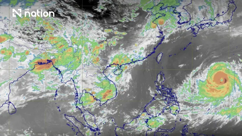


Typhoon Bavi is not expected to enter Thailand, but the storm will strengthen the monsoon and bring more rain, isolated heavy downpours and rougher seas from July 10–13.
Typhoon Bavi is not expected to move into Thailand, but the storm will strengthen the monsoon and bring heavier rain to many parts of the country from July 10, the Thai Meteorological Department warned on Tuesday.
The department said Bavi, currently over the Pacific Ocean, is forecast to move past Taiwan and make landfall along China’s eastern coast between July 11 and 12. Travellers planning to visit Taiwan or China during that period have been advised to check weather updates before departure.
Although the typhoon will not directly hit Thailand, its indirect influence is expected to intensify the southwest monsoon over the Andaman Sea, Thailand and the Gulf of Thailand from July 10 to 13, bringing more thundershowers and isolated heavy rain nationwide.
Monsoon to strengthen from July 10
According to the TMD’s seven-day forecast, rainfall in Thailand is expected to decrease slightly during July 7–9, although isolated heavy rain remains possible in the North and upper Northeast.
From July 10–13, however, the monsoon trough is expected to lie across Myanmar, Laos and upper Vietnam, while the southwest monsoon over Thailand and nearby seas will become stronger.
This will bring more rain across the country, with isolated heavy rain in the North, Northeast and the South’s west coast, and isolated very heavy rain in the East.
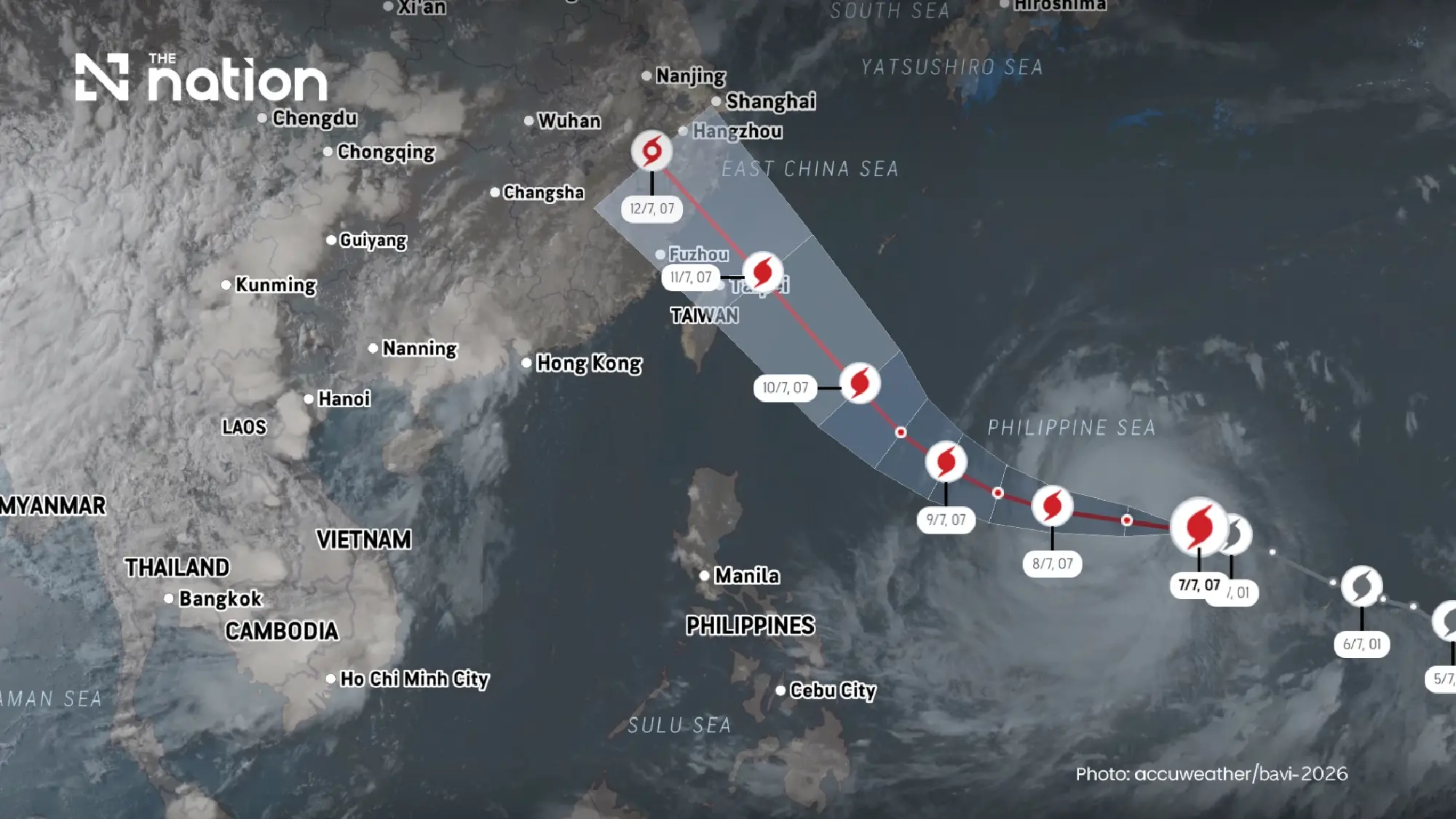

Regional outlook from July 10–13
The TMD forecast shows widespread rain in several regions during the stronger monsoon period.
- North: Thundershowers in 60–70% of the area from July 11–13, with isolated heavy rain.
- Northeast: Thundershowers in 60–70% of the area from July 11–13, with isolated heavy rain.
- Central region: Thundershowers in 60–70% of the area from July 11–13, with isolated heavy rain.
- East: Thundershowers in 40–60% of the area from July 10–13, with isolated heavy to very heavy rain.
- South, east coast: Thundershowers in 30–40% of the area from July 10–13, mostly in the upper South.
- South, west coast: Thundershowers in 40–60% of the area from July 10–13, with isolated heavy rain.
- Bangkok and surrounding provinces: Thundershowers in 60–70% of the area from July 11–13, with isolated heavy rain.
Rough seas expected in Andaman and Gulf
Marine conditions are also expected to worsen as the monsoon strengthens.
During July 10–13, waves in the upper Andaman Sea are forecast to reach 2–3 metres, rising above 3 metres in thundershowers. In the lower Andaman Sea and upper Gulf of Thailand, waves are expected to be around 2 metres, rising above 2 metres during storms.
The TMD advised all vessels in the Andaman Sea and the Gulf to proceed with caution and avoid sailing in areas with thundershowers. Small boats in the upper Andaman Sea should remain ashore during July 10–13.
Flood-prone areas urged to stay alert
The department warned residents, especially in the North and Northeast, to watch for heavy and accumulated rain that could trigger flash floods, forest run-off and overflowing waterways.
People living near foothills, waterways and low-lying areas have been urged to monitor weather updates closely during the period of heavier rainfall.
The latest advisory underlines that while Bavi is not a direct threat to Thailand, its wider weather influence could still affect travel, farming, marine transport and flood-prone communities across the country.
