
Thailand faces uneven water picture as Pasak drops to 13%
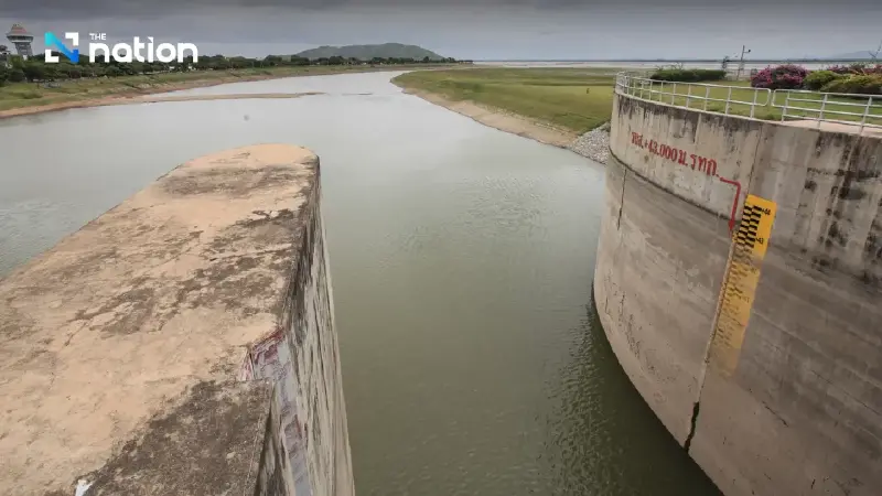


Water storage at Pasak Jolasid Dam has dropped to only 13% of capacity, highlighting sharp differences in reservoir levels across Thailand as authorities prepare for rainfall to ease over the coming days
- The Pasak Jolasid Dam's water level has dropped to 13% of its capacity, holding 117 million cubic metres, the lowest among the four main reservoirs in the Chao Phraya basin.
- A high-tide warning remains in effect for low-lying communities along the Chao Phraya, Mae Klong, and Tha Chin rivers.
- Authorities have advised residents in at-risk areas to monitor water levels and prepare for potential riverside flooding.
- The Central region, which relies on the dam, has the lowest water storage in Thailand at just 28% of capacity.
The Office of the National Water Resources reported on Thursday (July 16) that the dam held 117 million cubic metres of water, the lowest level among the four main reservoirs supporting the Chao Phraya basin, the Central region and Bangkok.
The other three major reservoirs were in stronger positions. Bhumibol Dam held 7.205 billion cubic metres, or 54% of capacity, while Sirikit Dam contained 4.91 billion cubic metres, equivalent to 52%. Kwae Noi Bamrung Daen Dam stood at 227 million cubic metres, or 24%.

Central region records lowest water level
Reservoirs across Thailand contained a combined 44.616 billion cubic metres of water, representing 55% of total storage capacity. Of that amount, 20.493 billion cubic metres, or 36%, was classified as usable water.
The Central region recorded the lowest proportion of stored water at 28%, with a total of 5.31 billion cubic metres.
Western Thailand had the highest level, holding 18.342 billion cubic metres, or 65% of capacity. It was followed by the South at 61%, the North at 52%, the Northeast at 44% and the East at 40%.
The figures underline the need for careful water management in the Chao Phraya basin, particularly as Pasak Jolasid and Kwae Noi Bamrung Daen dams remain considerably lower than Bhumibol and Sirikit dams.
Trat records Thailand’s heaviest rainfall
Trat recorded the country’s highest accumulated rainfall over the previous 24 hours at 104 millimetres.
The highest regional totals were 89mm in Kamphaeng Phet in the North, 59mm in Pathum Thani in the Central region, 50mm in Kanchanaburi in the West, 54mm in Si Sa Ket in the Northeast and 71mm in Narathiwat in the South.
A moderate south-westerly monsoon continued to cover the Andaman Sea, Thailand and the Gulf of Thailand, bringing isolated heavy rain to the North, Northeast and East. Rainfall in the South was expected to decline.
From July 17–20, a low-pressure area is forecast to move across upper Vietnam while the south-westerly monsoon weakens. This is expected to reduce rainfall across much of Thailand, although isolated heavy downpours may persist in the North and upper Northeast.
Riverside communities warned of high tides
The water agency also maintained its warning over high tides through July 17 for low-lying communities along the Chao Phraya, Mae Klong and Tha Chin rivers.
Residents living outside flood embankments or in areas without permanent flood barriers were advised to monitor water levels closely and prepare for possible riverside flooding.
Motorists were urged to exercise particular caution on Sukhumvit, Suksawat and Rama II roads, where sections could be affected by waterlogging.
Authorities also advised residents not to leave vehicles or valuable belongings in low-lying riverside areas while elevated tides remain a concern.
