
Chao Phraya Dam to raise discharge to 900m³/s after heavy rain
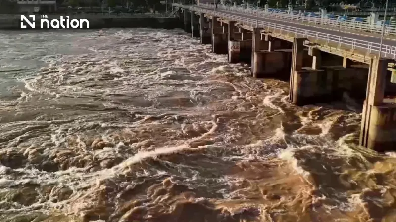


Residents outside Chao Phraya flood embankments are urged to stay alert despite forecasts of below-bank water levels at key downstream gauges.
- The Royal Irrigation Department is increasing the Chao Phraya Dam's discharge from 800 to 900 cubic metres per second starting November 10.
- This measure is a direct response to heavy rainfall in lower Northern and Central Thailand, which caused increased runoff into rivers that feed the dam.
- To reduce the impact downstream, water is also being diverted into irrigation and drainage canals on both sides of the Chao Phraya River.
- Authorities have warned residents in low-lying areas outside of flood embankments to remain alert, though water levels in major cities are expected to stay below the riverbanks.
The Royal Irrigation Department (RID) began increasing discharge through the Chao Phraya Dam from 800 to 900 cubic metres per second on November 10, 2026, following heavy rain in the lower North and Central Thailand, while urging residents in low-lying areas outside downstream flood embankments to remain alert.
According to RID forecasts through November 19, water levels at key monitoring stations in Pathum Thani, Nonthaburi and Bangkok are expected to remain below riverbank levels. Increased flows could nevertheless affect homes and farmland in low-lying areas outside flood defences.
Discharge increase and canal diversions
The RID began the gradual increase on the morning of November 10, with the adjustment scheduled for completion by 2pm. The department plans to maintain discharge at 900 cubic metres per second while monitoring and assessing upstream inflows around the clock.
The RID is also diverting water into irrigation systems on both the eastern and western sides of the Chao Phraya River. Routing water into irrigation and drainage canals is intended to reduce the volume flowing downstream and limit the impact on communities below the dam.

Wittaya Kaewmee, director-general of the RID, said flows from Nakhon Sawan province, combined with water from the Sakae Krang River, were expected to increase on November 10–13 before gradually declining.
“The Royal Irrigation Department has prepared a water management plan for the Chao Phraya Dam in advance, placing the highest priority on the impact on people living both upstream and downstream of the dam,” Wittaya said.
Heavy rain increases upstream runoff
Unsettled weather brought heavy to very heavy rain to several areas of the lower North and Central Thailand on November 5–7, following advance warnings from the Thai Meteorological Department.
Rapidly accumulating rainfall increased runoff into the Ping, Nan and Sakae Krang river basins. These flows feed into the Chao Phraya River, contributing to a renewed rise in water upstream of the dam.
Rainfall measurements for November 6–7 showed an accumulated total of 172.5mm in Lan Sak district, Uthai Thani, the highest of the reported readings. Nakhon Thai district in Phitsanulok recorded 130.0mm, while Kosamphi Nakhon district in Kamphaeng Phet recorded 125.4mm.
Advance warnings for vulnerable communities
The RID is coordinating with provincial and district authorities, local administrative organisations and other relevant agencies to provide advance warnings to people in at-risk areas.

Residents along the Chao Phraya River, particularly in low-lying areas outside flood embankments, have been urged to remain vigilant and follow official announcements.
Wittaya said accumulated rainfall, upstream inflows and forecasts would guide water management, with plans adjusted in real time to minimise the impact on lives and property.
The department’s response follows the policy of Suriya Juangroongruangkit, minister of agriculture and cooperatives, who has instructed agencies under the ministry to prepare fully for natural disasters. Discharge plans are to be adjusted as conditions change, with the aim of keeping water at safe levels and alleviating hardship.
Updates on water conditions, warnings and water management are available through the RID website or its 24-hour hotline, 1460.
