
Flood risk rises as strong monsoon brings heavy rain to Thailand
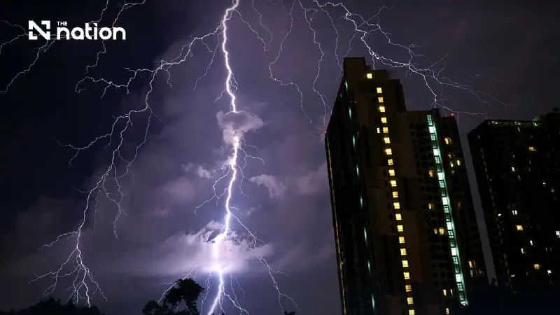


Very heavy rain is possible in the western Central region, the East and the west coast of the South, while waves may exceed four metres.
- A strong southwest monsoon is causing heavy to very heavy rainfall across Thailand, increasing the risk of flash floods and runoff.
- Residents in affected areas, particularly the western Central region, the East, and the west coast of the South, have been warned about the severe weather.
- The monsoon is also generating strong winds and high waves (up to 4 meters or more) in the Andaman Sea and Gulf of Thailand, prompting a warning for small boats to remain ashore.
The Thai Meteorological Department (TMD) forecast isolated heavy rain across Thailand over the next 24 hours on Sunday (July 12, 2026), with very heavy rain possible in parts of the western Central region, the East and the west coast of the South.
A strong south-west monsoon covers the Andaman Sea, Thailand and the Gulf of Thailand, while a low-pressure cell lies over upper Vietnam.
Residents in the affected areas were advised to beware of heavy to very heavy rain and accumulated rainfall that could cause flash floods and run-off, particularly on foothill slopes near waterways and in low-lying areas.
Wind and waves in the Andaman Sea and the Gulf of Thailand are strengthening.

Waves in the upper Andaman Sea are forecast at 2-4 metres and above 4 metres in thunderstorms.
The lower Andaman Sea and upper Gulf of Thailand are expected to have waves of 2-3 metres, rising above 3 metres in thunderstorms.
Mariners should proceed with caution and avoid areas with thunderstorms.
Small boats in the Andaman Sea and upper Gulf of Thailand should remain ashore until Wednesday (July 15, 2026), while people along the west coast of the South should beware of waves washing ashore.
Typhoon Bavi has made landfall in Zhejiang province, China, and is expected to weaken into a tropical storm and then a tropical depression.
The storm is not forecast to enter Thailand.
Travellers to the area should check weather conditions before departure.

Forecast for Thailand from 6am Sunday (July 12) to 6am Monday (July 13)
Bangkok and surrounding areas
- Thunderstorms are forecast across 60% of the area.
- Temperatures will range from lows of 26-28°C to highs of 33-35°C, with south-westerly winds of 10-25 km/h.
North
- Thunderstorms are expected across 70% of the region, with isolated heavy rain in Mae Hong Son, Chiang Mai, Chiang Rai, Phayao, Nan and Tak.
- Temperatures will range from lows of 23-27°C to highs of 30-34°C, with south-westerly winds of 10-20 km/h.
Northeast
- Thunderstorms are forecast across 70% of the region, with isolated heavy rain in Nong Khai, Bueng Kan, Udon Thani, Sakon Nakhon, Nakhon Phanom, Mukdahan, Amnat Charoen and Ubon Ratchathani.
- Temperatures will range from lows of 23-26°C to highs of 28-34°C, with south-westerly winds of 10-20 km/h.
Central region
- Thunderstorms are expected across 60% of the region, with isolated heavy to very heavy rain in Kanchanaburi and Ratchaburi.
- Temperatures will range from lows of 23-26°C to highs of 32-35°C, with south-westerly winds of 10-25 km/h.
East
- Thunderstorms are forecast across 60% of the region, with isolated heavy to very heavy rain in Nakhon Nayok, Prachin Buri, Sa Kaeo, Chanthaburi and Trat.
- Temperatures will range from lows of 23-28°C to highs of 31-35°C, with south-westerly winds of 20-40 km/h.
- Waves are expected to reach 2-3 metres and rise above 3 metres in thunderstorms.
South, east coast
- Thunderstorms are forecast across 40% of the region, with isolated heavy rain in Phetchaburi, Prachuap Khiri Khan, Chumphon and Surat Thani.
- Temperatures will range from lows of 23-26°C to highs of 34-36°C.
- From Surat Thani northwards, south-westerly winds will reach 20-40 km/h, with waves of 1-2 metres and above 2 metres offshore and in thunderstorms. From Nakhon Si Thammarat southwards, winds will reach 20-35 km/h, with waves of 1-2 metres, about 2 metres offshore and above 2 metres in thunderstorms.
South, west coast
- Thunderstorms are forecast across 60% of the region, with isolated heavy to very heavy rain in Ranong, Phang Nga, Phuket and Krabi.
- Temperatures will range from lows of 23-27°C to highs of 29-34°C.
- From Phuket northwards, south-westerly winds will reach 20-45 km/h, with waves of 2-4 metres and above 4 metres in thunderstorms. From Krabi southwards, winds will reach 20-40 km/h, with waves of 2-3 metres and above 3 metres in thunderstorms.
