Experts warn Bangkok could face another major flood between 2030 and 2034 unless water management and urban resilience improve
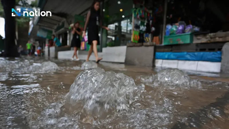
Bangkok could face another major flood between 2030 and 2034 if the city fails to strengthen its long-term water management and climate-resilience systems, experts warned at a Senate seminar.
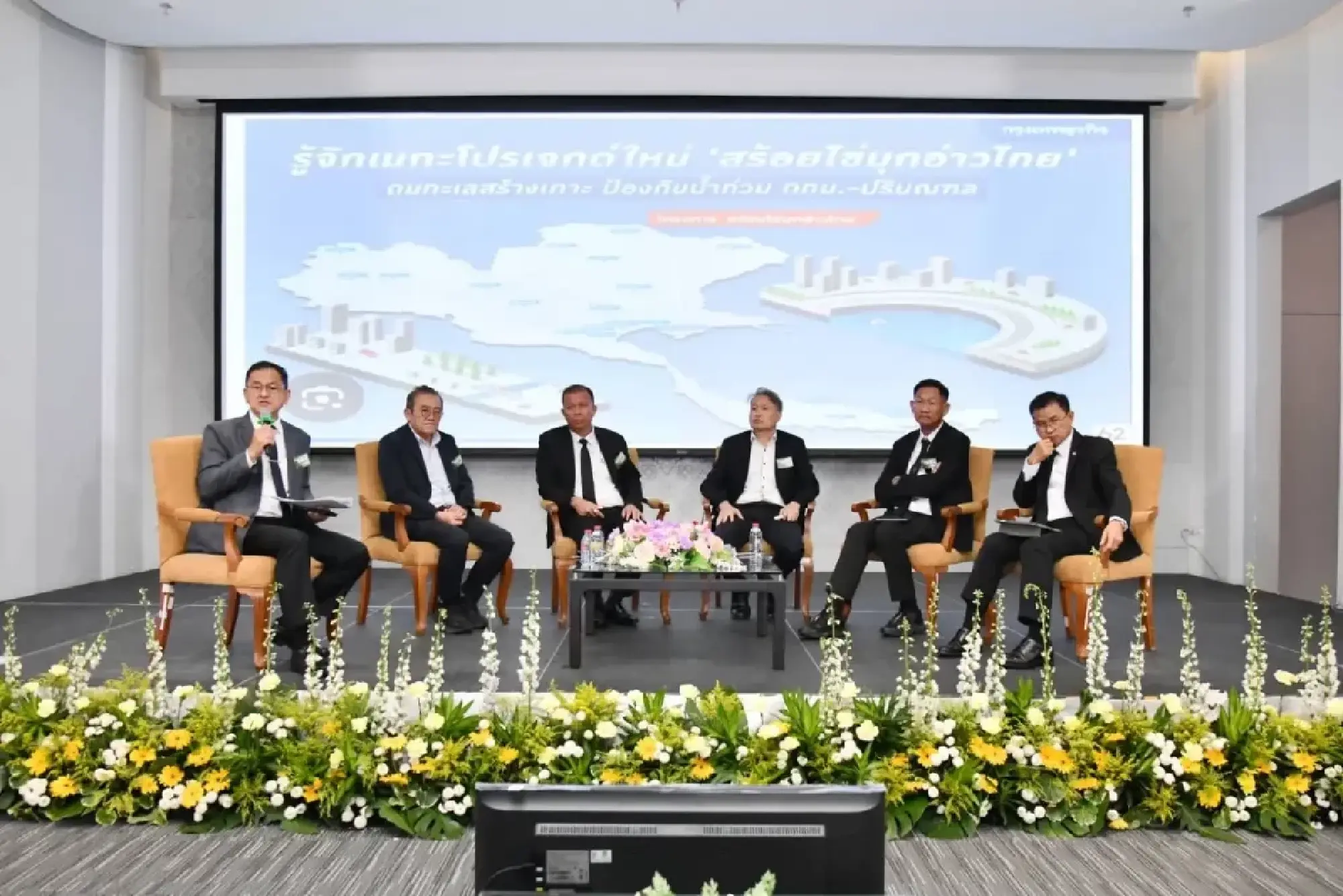
The Senate Committee on Public Administration held a forum under the theme “Bangkok 2030-2034: The Next Great Flood” to assess the capital’s flood risks and lay the groundwork for future prevention measures.
The discussion brought together experts and relevant agencies to draw lessons from the 2011 floods and prepare for more extreme climate conditions that could emerge over the next four to five years.
Speakers agreed that Bangkok in 2030 will need more than engineering infrastructure. Flood prevention will also depend on integrated urban planning, better governance and cooperation among all sectors to reduce the damage if a major flood similar to 2011 occurs again.
Lessons from 2011
Dr Somkiat Prajamwong, a member of the Senate subcommittee on disaster management, former secretary-general of the Office of the National Water Resources (ONWR) and former director-general of the Royal Irrigation Department, said the seminar aimed to make all agencies aware of flood risks in 2030 and the need to begin long-term protection measures now.
Citing the IPCC 2023 report, he said global temperatures were moving towards a point that could become irreversible, making climate change harder to address and increasing disaster risks.
Somkiat said the 2011 floods, which caused more than 1.44 trillion baht in economic damage, showed that disaster occurs when natural hazards meet the vulnerability of an area, including dense communities and high exposure to risk.
He said the Chao Phraya River basin was now facing floods more frequently. What was once a roughly 30-year cycle has become almost an annual problem.
Bangkok’s physical constraints include:
Low-lying land: Bangkok is basin-shaped and sits no more than 1 metre above average sea level. Its elevation is similar to the Netherlands, but the city also faces serious land subsidence that remains difficult to solve.
Rapid urban expansion: Roads and buildings have blocked natural waterways, while communities have expanded on both the eastern and western sides of the city. As a result, rainwater enters low-lying areas faster and becomes harder to drain.
Drainage bottlenecks: Although the Khlong Lat Pho project helps speed up drainage, the lower Chao Phraya River has only a slight gradient, causing water to flow slowly into the sea during a crisis.
Somkiat said water management still had weak links, even with ONWR serving as a central agency. Coordination inside and outside Bangkok remained a major issue that must be solved if the city is to cope with a real crisis.
Bangkok focuses on three water threats
Jesada Jantharaprabha, director of Bangkok Metropolitan Administration’s Department of Drainage and Sewerage, said Bangkok is located on the Chao Phraya River delta at only 0-2 metres above sea level. Many areas on the Phra Nakhon side are low-lying.
He said the city’s main flood risks come from “three waters”:
northern run-off
storm surges
rainfall
Among the three, rainfall is now the biggest concern because of “rain bomb” events and the urban heat island effect, which can intensify heavy downpours over the city.
Bangkok is accelerating infrastructure development, including flood embankments along the Chao Phraya River with heights of 2.80-3.50 metres, as well as giant drainage tunnels that move water directly from inner-city areas into the river.
Four tunnels are already in operation, while another at Nong Bon swamp is undergoing system testing. The tunnel is expected to help ease flooding in Udom Suk and Khlong Bang Na areas.
The city has also introduced “Water Bank” underground storage tanks in low-lying areas, including beneath sports fields and public parks near the Ratchada-Vibhavadi intersection. The system is designed to hold excess water during the first 15 minutes of heavy rainfall.
Jesada said Bangkok had increased its rainwater drainage capacity from 60 millimetres per hour to 80 millimetres per hour. The city has also deployed automated monitoring technology at more than 300 locations, together with weather radar capable of forecasting rainfall three hours in advance.
He said lessons from 2022, when rainfall exceeded the average by 40%, had been used to improve the system. Flood-risk points in Bangkok have fallen from 481 to 256, with all remaining points being addressed under the 2025 budget plan.
Industry urges stronger investor confidence
Chuchat Saitin, adviser to the Water, Environment and Climate Change Institute under the Federation of Thai Industries, said the 2011 floods severely affected industrial estates in the lower Chao Phraya basin.
The estates included Saha Rattana Nakorn, Rojana, Hi-Tech, Bang Pa-in, Navanakorn and Bangkadi. Total damage exceeded 200 billion baht, covering machinery repairs, the relocation of raw materials and goods, and disruption to supply chains.
The industrial sector has since adapted by building flood barriers, installing pumping systems and raising machinery to higher levels. Some companies have also relocated production bases to lower-risk areas, including the Eastern region.
Chuchat said disaster risk affects investment decisions over a 15- to 20-year horizon. He urged the government to improve water management, rainfall forecasting, reservoir operations and drainage routes to build investor confidence and protect Thailand’s long-term competitiveness.
High-risk period expected from 2030 to 2034
Assoc Prof Seree Supratid, director of the Climate Change and Disaster Centre at Rangsit University, said Bangkok and its surrounding provinces are facing “compounding” factors that could make floods more severe.
He cited a 21.47% increase in accumulated rainfall over six months and a rise in sea level of 1.3-2.3 centimetres per year, driven by global warming and land subsidence.
AI analysis of the latest data showed that 2030-2034 would be a high-risk period for major flooding, with 2031 requiring particular attention. Floodwater volume in the Chao Phraya River basin could rise by 20-25% by 2030 if no supporting measures are put in place.
Dr Seree proposed three key pillars for flood response:
proactive warning systems
flexible and resilient infrastructure
long-term adaptation measures
He warned that floodwalls alone may not be enough because Bangkok still relies heavily on pumping systems, which have limits when dealing with large volumes of water.
The warning also reflects wider climate pressure on Thailand. Earlier climate-risk assessments have pointed to the country’s rising exposure to extreme weather, including heavy rain, flooding and heatwaves, while the government has been pushing to improve disaster preparedness, early warning systems and climate resilience.
ONWR outlines nine flood-management plans
Chayan Muangsong, secretary-general of ONWR, said the agency is working on an integrated water-management plan built around nine main plans and large-scale drainage canal projects to reduce flood risks in Bangkok and surrounding provinces amid the challenge of climate change.
One major project is the Bang Ban-Bang Sai drainage scheme, which is more than 66% complete and expected to finish in 2030. It will increase drainage capacity from 1,200 cubic metres per second to 2,400 cubic metres per second, helping reduce flooding in Phra Nakhon Si Ayutthaya province.
Another project involves improving the Chai Nat-Pa Sak canal to raise drainage capacity from 120 cubic metres per second to 930 cubic metres per second, helping divert floodwater before it reaches Bangkok.
However, the projects still face obstacles, including land expropriation, utility relocation and the environmental impact assessment process.
Two-layer flood barriers and mangrove restoration
Jirat Jutathamphorn, a landscape architect and expert on coastal flood barriers, proposed a “two-layer flood barrier” concept combined with mangrove restoration.
He said nature is changing so rapidly that old statistical data can no longer be used to forecast the future reliably. Thailand therefore needs new flood-prevention designs that suit its own context, rather than copying foreign models entirely.
Under the proposal, the two-layer flood barrier would use a curved design instead of a straight line. The space between the two barriers would serve as a water-retention area to balance northern run-off and storm surges.
The same area could also be developed into mangrove forest, helping accumulate sediment, provide nursery grounds for aquatic animals and strengthen food security.